Iceland Lighthouses: The Most Beautiful, Remote, and Scenic
Iceland’s lighthouses are not a single attraction circuit.
They are bright punctuation marks on volcanic peninsulas, bird cliffs, fishing harbors, and remote gravel roads, so the right route depends on whether you have an afternoon near Reykjavík or two summer weeks to circle the country.
Route 1: Reykjavík and the Reykjanes Peninsula
These three lights fit into one long day, although Grótta is also an easy separate outing from central Reykjavík. Confirm Reykjanes road access before leaving because volcanic closures can affect the peninsula independently of conditions in the capital.
1. Grótta Lighthouse
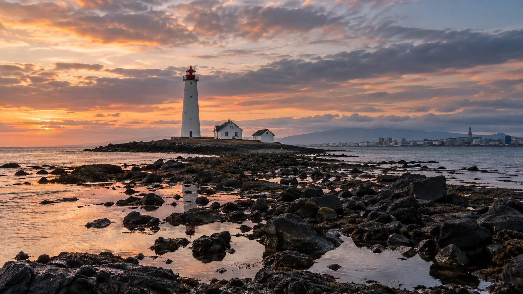
Arrival plan: park at the mainland end of the Seltjarnarnes coastal road and follow the shoreline path; allow 30 to 60 minutes for mainland views or a permitted low-tide crossing. The mainland walk is much easier underfoot than the rocky, slippery causeway, and the tower has no routine interior visit.
Use the Grótta tide forecast, which uses the nearby Reykjavík station, before deciding whether to cross. Skip the island during nesting closure, a rising tide, or rough water, and remember that wind can change the actual water level from the prediction.
Grótta sits on a small tidal island at the end of the Seltjarnarnes peninsula, with Reykjavík’s skyline behind you and open Faxaflói Bay ahead. At low tide and outside closure periods, visitors may walk the causeway, but the lighthouse itself is not a public tower climb.
From May 1 through July 15, the island is closed to protect breeding birds, according to the official Grótta visitor information. Respect the closure completely, then enjoy the mainland path and nearby Kvika footbath instead.
Outside nesting season, check the tide before crossing and return well before water covers the route. A lighthouse photo is not a reliable tide table, and cold seawater can cut off a casual walker very quickly.
2. Garðskagi lighthouses
Arrival plan: drive through Garður to the lighthouse and museum grounds, use the visitor parking, and take the short mostly level paths between the two lights. Allow 30 to 45 minutes outside and treat an open museum or tower as an optional extra, with no promised interior access.
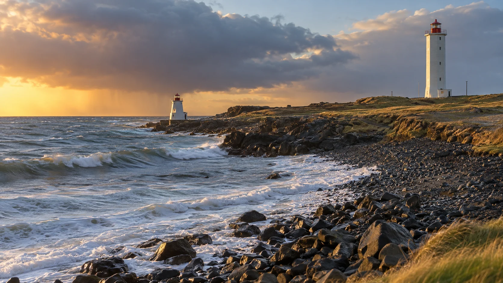
The regional lighthouse account explains the older light’s clever low position: it could shine below mist, but surf made that position vulnerable. Choose this stop over a rough-road lighthouse with limited mobility, while skipping the seaward path when waves wash across it.
Garðskagi has an older low lighthouse and a newer 92-foot tower built in 1944. The pair sits in an easy coastal setting near Garður, making this one of the peninsula’s friendliest exterior stops.
The grounds are the dependable attraction, while any interior access or exhibition hours require a current local check. The area is also good for birding, but give resting and feeding birds plenty of space.
3. Reykjanesviti
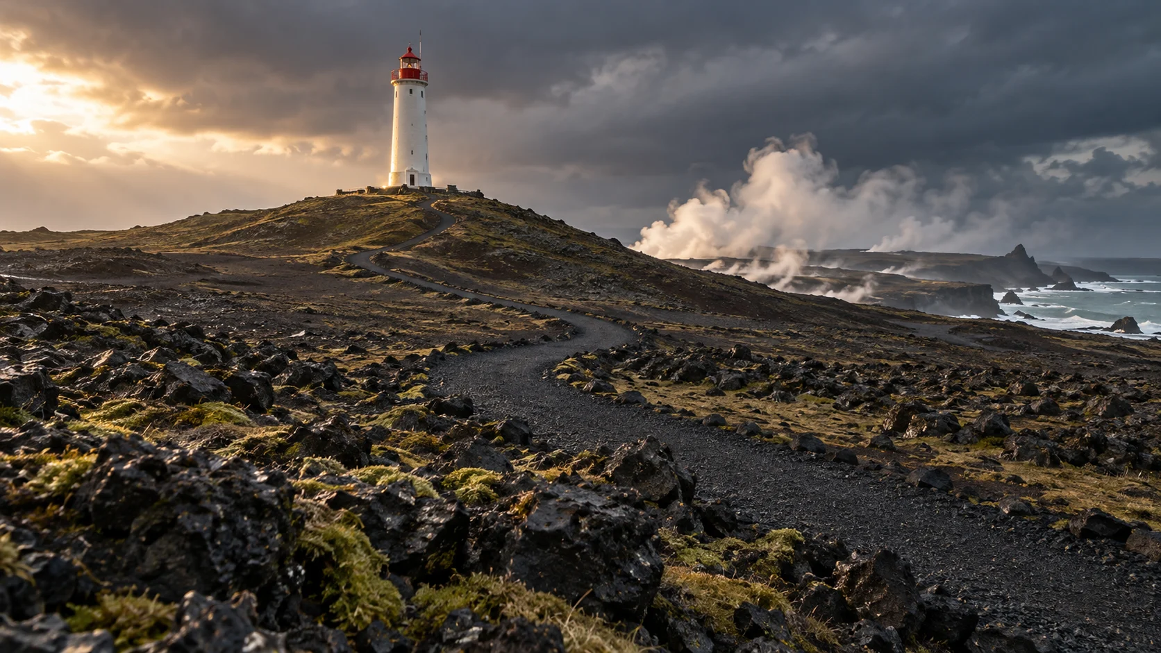
Arrival plan: follow the signed open approach to the lighthouse/Gunnuhver area and use established parking, then follow the marked approach toward Bæjarfell for the exterior view. Allow 45 to 60 minutes for a short visit, with uphill gravel walking if you approach the tower; skip it when volcanic restrictions close the route or wind makes the exposed paths uncomfortable.
Reykjanesviti replaced Iceland’s first lighthouse after earthquakes and surf destabilized the original site at Valahnúkur. Today’s 85-foot tower stands on Bæjarfell near Gunnuhver’s geothermal landscape and the peninsula’s raw southwestern coast.
The official tourism authority explicitly says visitors cannot go inside the lighthouse. A seasonal visitor center in the old engine-house area provides the interpretation, while the tower and surrounding geological views are enjoyed from outside.
Stay on marked geothermal paths and behind cliff barriers because thin crust, steam, unstable rock, and heavy surf are separate hazards. Before driving, verify both regional access notices and road conditions rather than relying on last year’s volcanic map.
For a complete first visit, the realistic eight-day Iceland route shows where this peninsula fits without sacrificing the South Coast or Golden Circle.
Route 2: Akranes and Snæfellsnes
Akranes is an easy stop north of Reykjavík, while Snæfellsnes deserves its own full day or overnight. Combine them only in summer when daylight is generous and you are comfortable returning late.
4. Akranes lighthouses
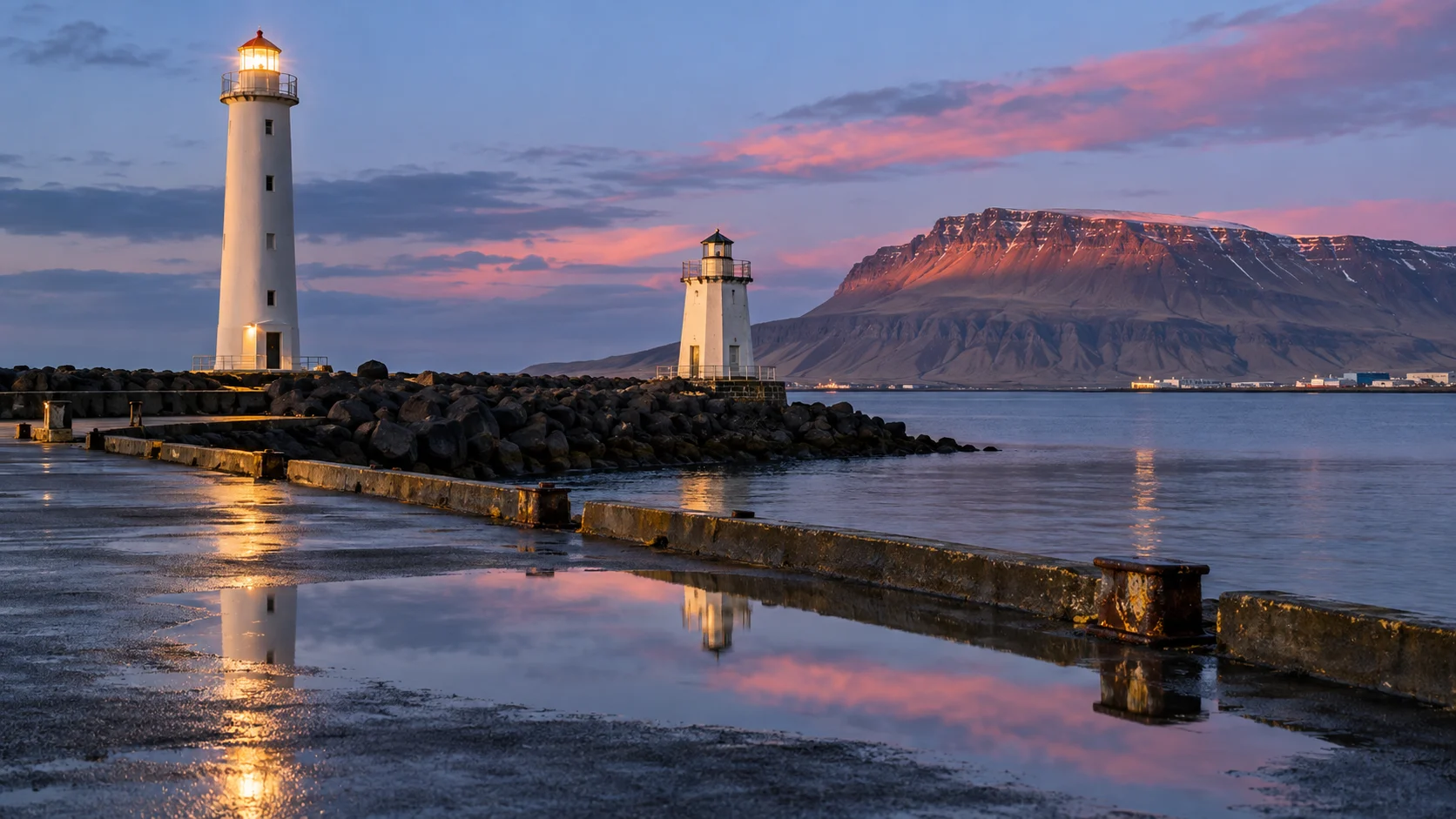
Arrival plan: drive to Breiðin harbor’s lighthouse visitor area and park clear of working harbor access, then walk a few minutes on the established grounds. Allow 45 to 60 minutes for the two exteriors and a staffed climb, or 20 to 30 minutes if you stay outside.
Akranes is my choice when the point of the outing is actually climbing a lighthouse, because public access is part of the attraction during staffed hours. Skip the climb if stairs are difficult or staff suspend access for weather, and enjoy the easy exterior view instead.
Two lighthouses stand at Breiðin on Akranes harbor, and the larger active tower is one of Iceland’s clearest opportunities for an interior climb. It also serves as the town’s visitor information point and hosts exhibitions.
Official hours vary by season, and different Visit West Iceland pages have published different schedules. Confirm directly on the day rather than trusting a cached listing, then enjoy both exterior lights if the door is closed.
This is true public tower access during staffed hours, not permission to enter at any other time. The climb involves stairs and may pause for weather or operations.
5. Malarrif Lighthouse
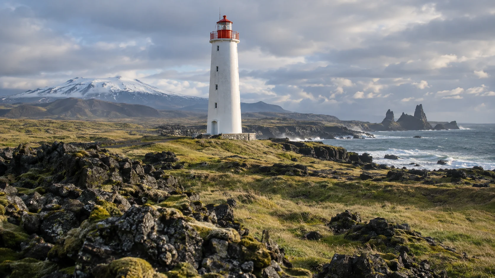
Arrival plan: park at the Malarrif visitor center and follow the marked paths to the tower and toward Lóndrangar. Give the exterior and visitor center 30 to 45 minutes, or allow 1.5 to 2 hours for an out-and-back landscape walk with photo stops, turning around when you have used half your walking time.
This is the walk I’d protect on a one-day Snæfellsnes plan: the lighthouse, lava, and rock pinnacles make a satisfying stop without a remote road commitment. The paths include uneven lava and gravel, so I’d shorten it at the visitor center in ice, strong wind, or when footing becomes tiring.
Malarrif’s white tower sits within Snæfellsjökull National Park near Lóndrangar. Parking, walking paths, picnic space, restrooms, and a staffed visitor center make the surrounding stop easy to understand.
The park’s FAQ is wonderfully unambiguous: the lighthouse is closed and not open to the public. Visit the exterior, ask rangers about current trail conditions, and use the visitor center for the human and natural history of this coast.
A roughly 3.75-mile park trail connects Djúpalónssandur and Malarrif, while a shorter route continues toward Lóndrangar and Svalþúfa. Use the park’s current trail grading rather than assuming a low-mileage lava walk will be easy underfoot.
6. Skálasnagi Lighthouse and Svörtuloft cliffs
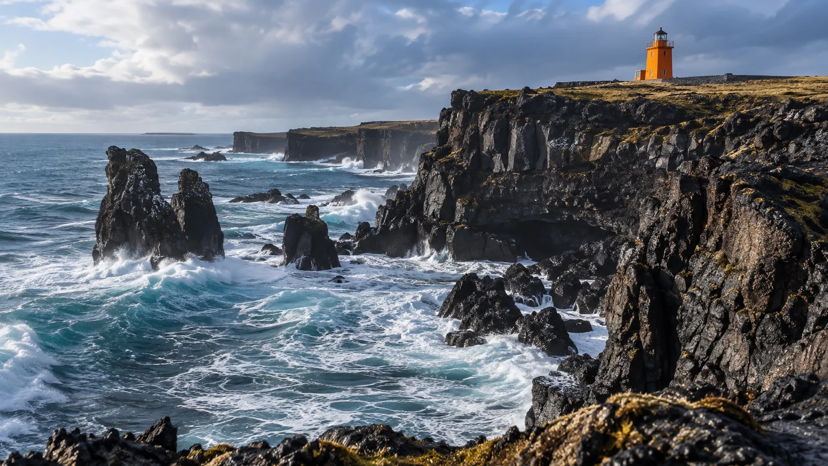
Arrival plan: leave the main peninsula road for Road 579, then take the signed branch to Skálasnagi/Svörtuloft and park at the designated end area. Allow 20 to 40 minutes for the short uneven approach and cliff viewpoints; the tower is an exterior stop, and I’d skip the branch if potholes, snow, or wind exceed my vehicle’s or walking comfort.
Skálasnagi is the orange lighthouse above the sea cliffs called Svörtuloft. It is reached within the national park’s western tip, where parking and viewpoints make an exterior visit possible without stepping toward a fragile edge.
The official path between Öndverðarnes and Skálasnagi is about 1.25 miles through black lava and is rated demanding. That rating matters more than the short distance, especially in wind, ice, or poor visibility.
Do not confuse Skálasnagi with the small yellow Öndverðarnes lighthouse nearby. Both can fit into a good-weather day by car, but narrow, rough final roads require slow driving and may be restricted after storms or during winter.
The national park visitor center is the best place to ask what is open that day. It is also a much better source than a rental-car forum for deciding whether to continue around the peninsula.
Öndverðarnes Lighthouse and the Fálki well
The small yellow light deserves its own stop, especially if you enjoy the human history behind an empty-looking coast. The official lighthouse listing identifies Road 579 and dates the current concrete tower to 1973, following the first light in 1909.
Arrival plan: turn from Road 574 onto Road 579, pass Skarðsvík, and follow the signed Öndverðarnes branch through the lava to the end parking area. Plan 30 to 45 minutes on short uneven paths around the exterior, settlement remains, and well; I’d not continue on a closed, deeply rutted, or icy final road.
The local history account describes a once-busy fishing settlement and a farm abandoned in 1945. Its Fálki well story says three kinds of water emerged here, which is a folktale to enjoy rather than a claim about drinkable water.
Pause at the well’s stone entrance and read the landscape, without climbing into ruins or assuming the old steps are safe. For a longer hike, the demanding lava trail connects to Skálasnagi, but driving between the two is my choice when the day also includes Malarrif.
Skarðsvík makes a purposeful 15 to 30-minute break on the way back because its pale sand contrasts with the surrounding dark lava. View it from the approach if the surf is strong; low tide creates more beach but never guarantees safe water, and I’d not make this a swimming stop.
Route 3: the Westfjords lighthouse detour
7. Bjargtangar Lighthouse at Látrabjarg
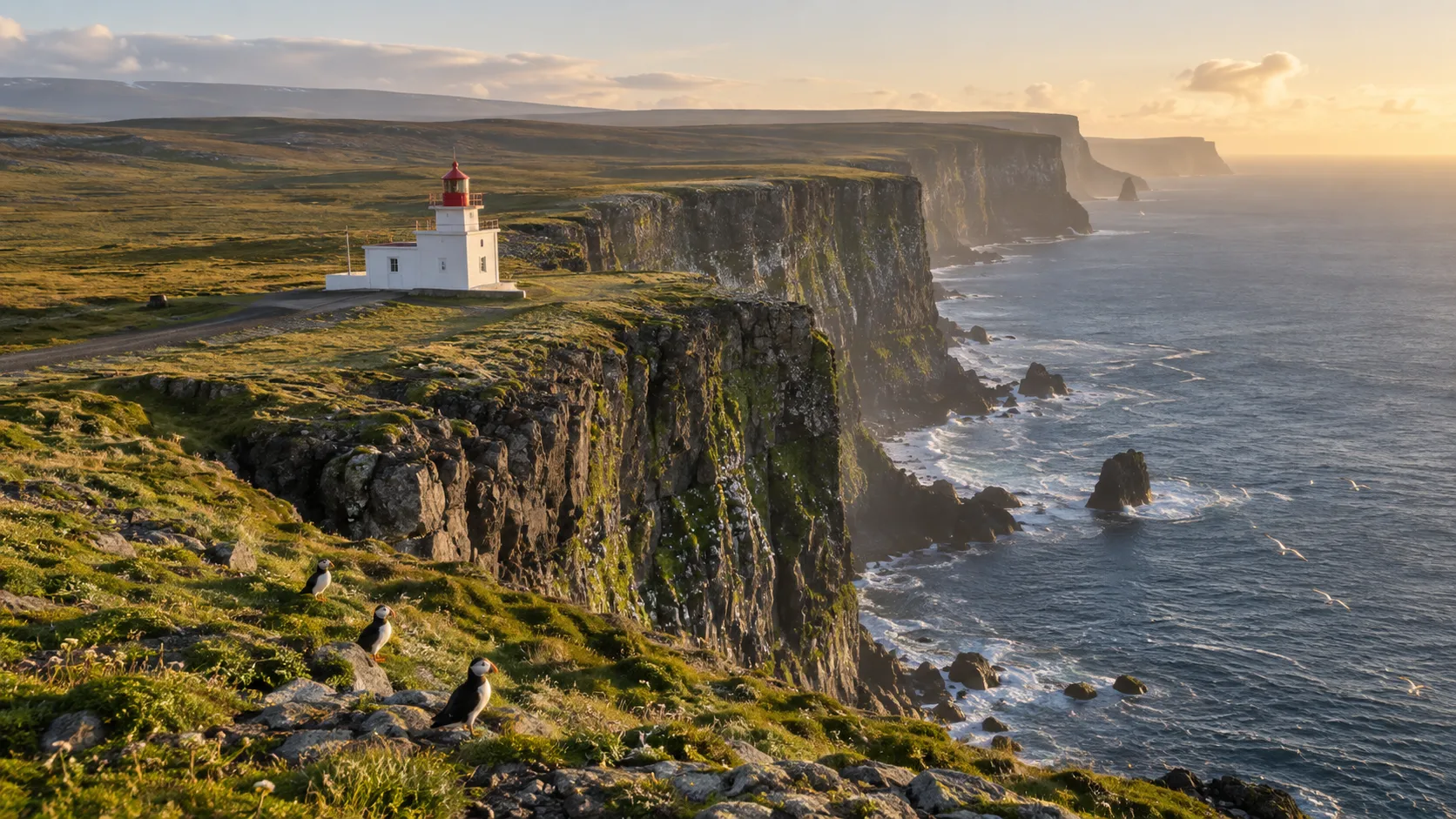
Arrival plan: use the marked parking at the end of Road 612 and the short path to the lighthouse exterior, then choose how far to continue on the uneven, rising clifftop path. Allow 30 minutes for the light or 1 to 2 hours with birds and a modest walk; skip the trip when Road 612 is closed or the clifftop wind affects your balance.
Bjargtangar marks the end of Road 612 at Látrabjarg’s immense seabird cliffs. The final section is gravel, road conditions vary, and the route is not maintained through winter.
This is a summer destination, not a quick Ring Road add-on. Allow at least a full day from the southern Westfjords and leave more time if ferry timing or slow gravel driving shapes your route.
The lighthouse is an exterior landmark beside the designated parking area. The main experience is the cliff walk, where bird burrows can weaken the turf right at an edge that drops hundreds of feet.
Stay behind barriers, never crawl to the lip for a puffin selfie, and use a zoom lens. The official Látrabjarg guidance also notes that drones require a nature-agency permit within the reserve.
Route 4: South Coast and Eastfjords
Knarrarósviti and Dyrhólaey sit near popular South Coast routes, while Vattarnes and Dalatangi are farther east. Dalatangi is a serious out-and-back detour and should only be added in stable summer conditions.
8. Knarrarósviti
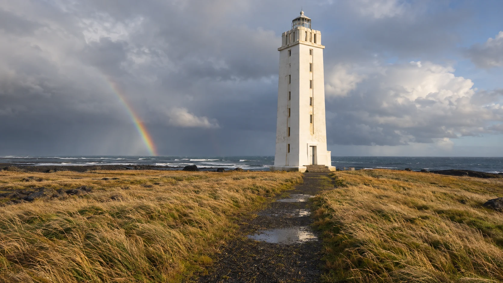
Arrival plan: follow the signed lighthouse turnoff from the Stokkseyri coastal road and use the established parking, leaving gates and access clear. The short ground-level approach makes a 20 to 30-minute exterior stop practical; add time only for confirmed summer opening, and skip exposed coastal walking in heavy surf or ice.
Knarrarósviti is an elegant concrete lighthouse near Stokkseyri, built in 1938 and 1939 with functionalist and art nouveau influences. It anchors the eastern end of South Iceland’s short Lighthouse Trail.
Official regional tourism information says the lighthouse opens daily for a limited summer period, generally from mid-June into early August. Verify that year’s dates and staffed hours before expecting entry, because the exterior remains the only guaranteed visit.
9. Dyrhólaey Lighthouse
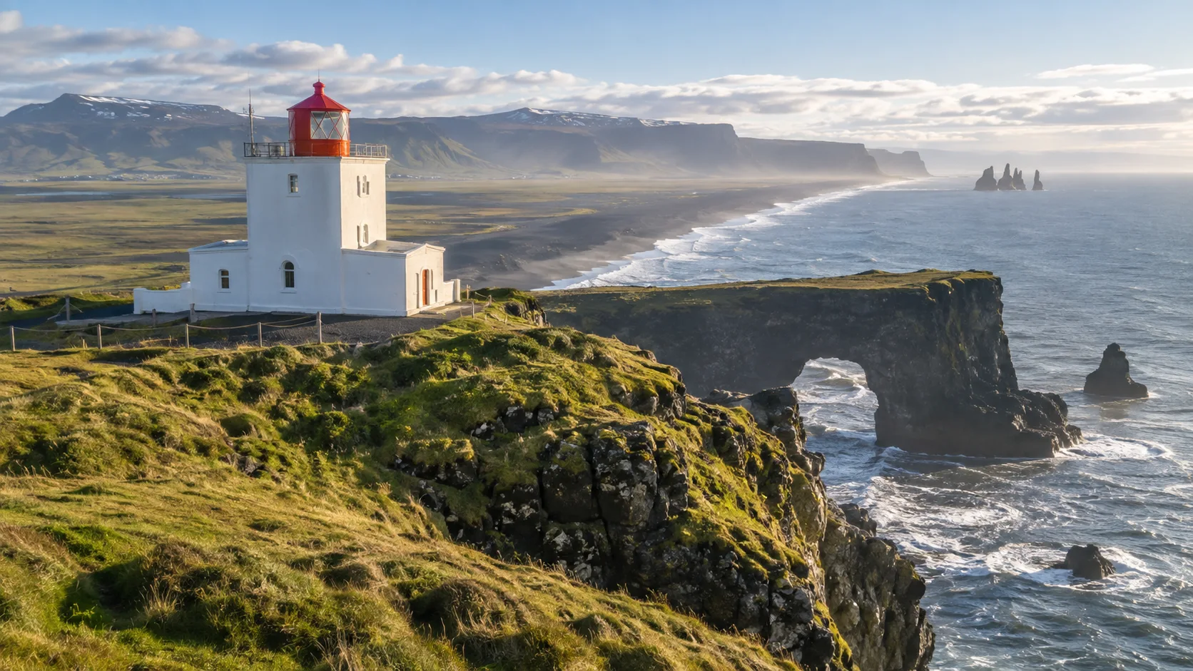
Arrival plan: Road 218 reaches the reserve, where the lower lot has easier road access and restrooms, while the upper lot is beside the lighthouse and arch viewpoints. The official regional guide gives the link between them as 1.3 km each way, with a sustained incline and moderately difficult walking.
Allow 45 to 60 minutes from the upper lot, or 1.5 to 2 hours from the lower lot if walking uphill and back, with extra time for birds. Choose the upper lot only when the road and your vehicle permit it, keep the tower visit outside, and skip the upper area if wind or nesting restrictions make access unsuitable.
Dyrhólaey’s square, orange-roofed lighthouse crowns the high section of the reserve near Vík. The arch, black-sand coast, and nesting seabirds are the real draw, while the lighthouse itself is viewed from outside.
Seasonal bird protection changes access, usually with daily hours restricted during part of May and June. Dates shift with nesting conditions, so use current signs and official notices rather than treating a past year’s schedule as permanent.
The high access road can be steep and rough, and temporary controls may direct some vehicles to the lower viewpoint. Wind at the top can be powerful enough to affect balance, so keep children close and stay away from the ledge.
10. Vattarnes Lighthouse
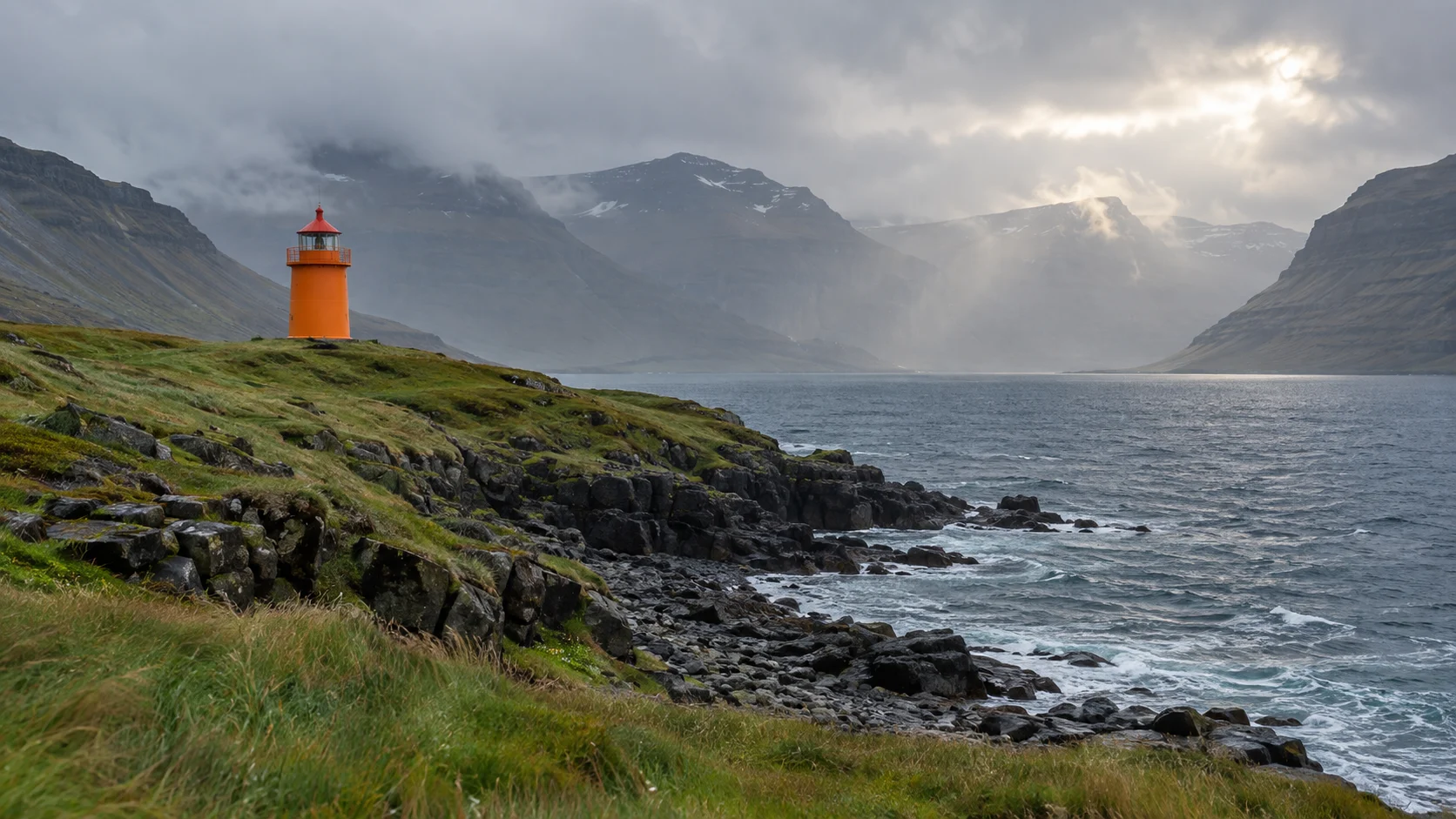
Arrival plan: use the officially listed Road 955 coastal route and look for a safe established roadside stopping place at the cape. Plan a 10 to 20-minute exterior photo stop from public roadside ground, without promising parking at the tower or a public walking route across private land.
If there is nowhere to pull completely off the carriageway, I’d keep driving and enjoy the coastal view from a later turnout. This is my easy Eastfjords choice when a full Dalatangi day would crowd the itinerary, but I’d take the tunnel if fog or road conditions remove the scenic benefit.
Vattarnesviti stands on the old coastal road between Reyðarfjörður and Fáskrúðsfjörður. The modern tunnel carries through traffic, making the peninsula road a scenic detour rather than the required route.
Only take that detour when weather and road status cooperate, and plan on exterior viewing. The tower standing today dates to 1957, replacing earlier lighthouse service at the cape.
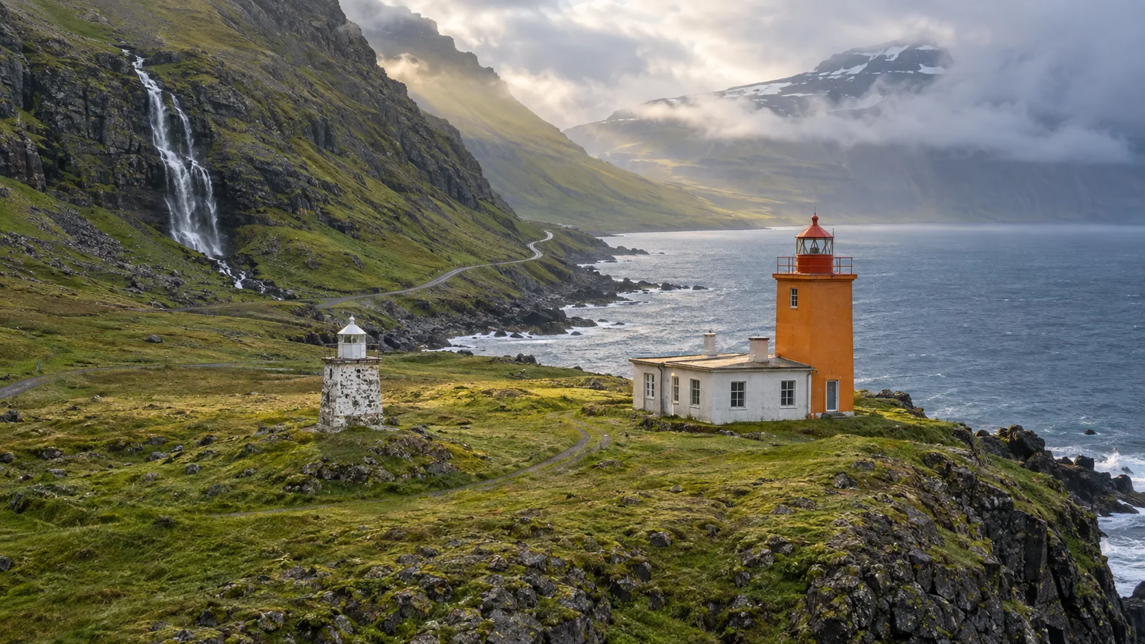
11. Dalatangi lighthouses
Arrival plan: follow Road 953 through Mjóifjörður to its coastal end, using only the visitor stopping area and keeping the residence, weather-station access, and working drive clear. Allow 30 to 45 minutes on the short uneven paths around the two exteriors, with no routine interior tour.
Choose Dalatangi only for a deliberately slow Eastfjords day, because the drive and isolated setting are much of the experience. Skip the final road in fog, after a landslide warning, or if passing places and the narrow coast feel uncomfortable; the regional arrival description makes clear why this is more demanding than a normal town stop.
Dalatangi has two lights: a small 1895 basalt structure and a 1908 lighthouse that remains in use. The pair rewards travelers interested in lighthouse history, but the approach is the deciding factor.
A narrow road winds east from tiny Mjóifjörður past steep slopes, waterfalls, and landslide terrain, then ends at Dalatangi. Do not attempt it in winter or poor conditions merely because an online map calculates a drive time.
These are exterior sights without a routine tower tour. The official East Iceland lighthouse overview confirms the two structures and makes clear that the road does not continue beyond the cape.
Route 5: Húsavík and the northeast coast
The north offers easy town lights and more remote peninsula stops. Choose two or three that fit your route rather than chasing all of them across long distances.
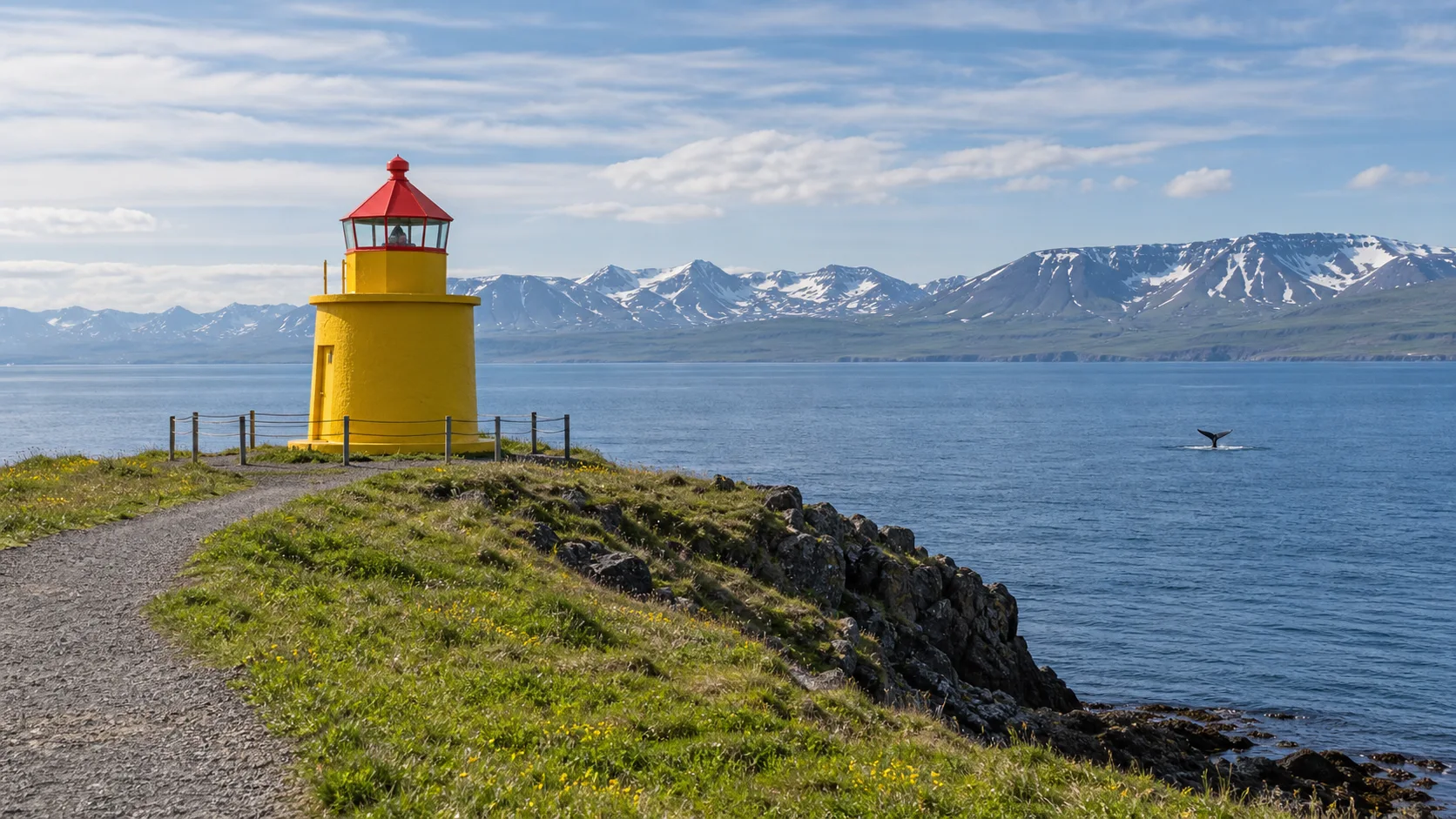
12. Húsavík Lighthouse
Arrival plan: park in the permitted area near GeoSea and follow the short coastal path to the yellow tower. Allow 15 to 30 minutes outside, with gentle ground but exposed grass or gravel; I’d skip the headland in ice or strong wind and keep the town or baths as the main outing.
Húsavík’s small yellow lighthouse is reached on a short walk after parking near GeoSea. It is an uncomplicated exterior stop that fits naturally before or after a whale-watching trip.
Stay on the public path and do not enter the tower. Travelers arriving by ship can use the Iceland cruise-port guide to compare Húsavík with the country’s larger calls.
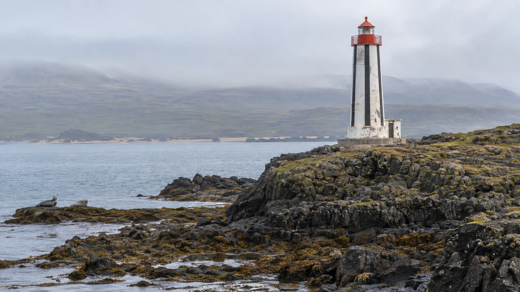
13. Kópasker Lighthouse
Arrival plan: start from Kópasker’s coastal walking route for a 30 to 60-minute outing, or use the permitted farm-gate approach only if local signs allow cars that day. Walking is on uneven coastal ground, interior access is not offered, and I’d skip the farm route if livestock, a locked gate, or a closure sign prevents passage.
A coastal walk leads from Kópasker toward the lighthouse, with seals and birds sometimes visible along the way. Official regional guidance also permits car access through a farmer’s gate, which must be closed behind you.
Treat livestock, private farming activity, and weather as part of the route rather than inconveniences. The light is an exterior stop, and wildlife should be observed from a respectful distance.
Separate northwest detour: Skagi Peninsula
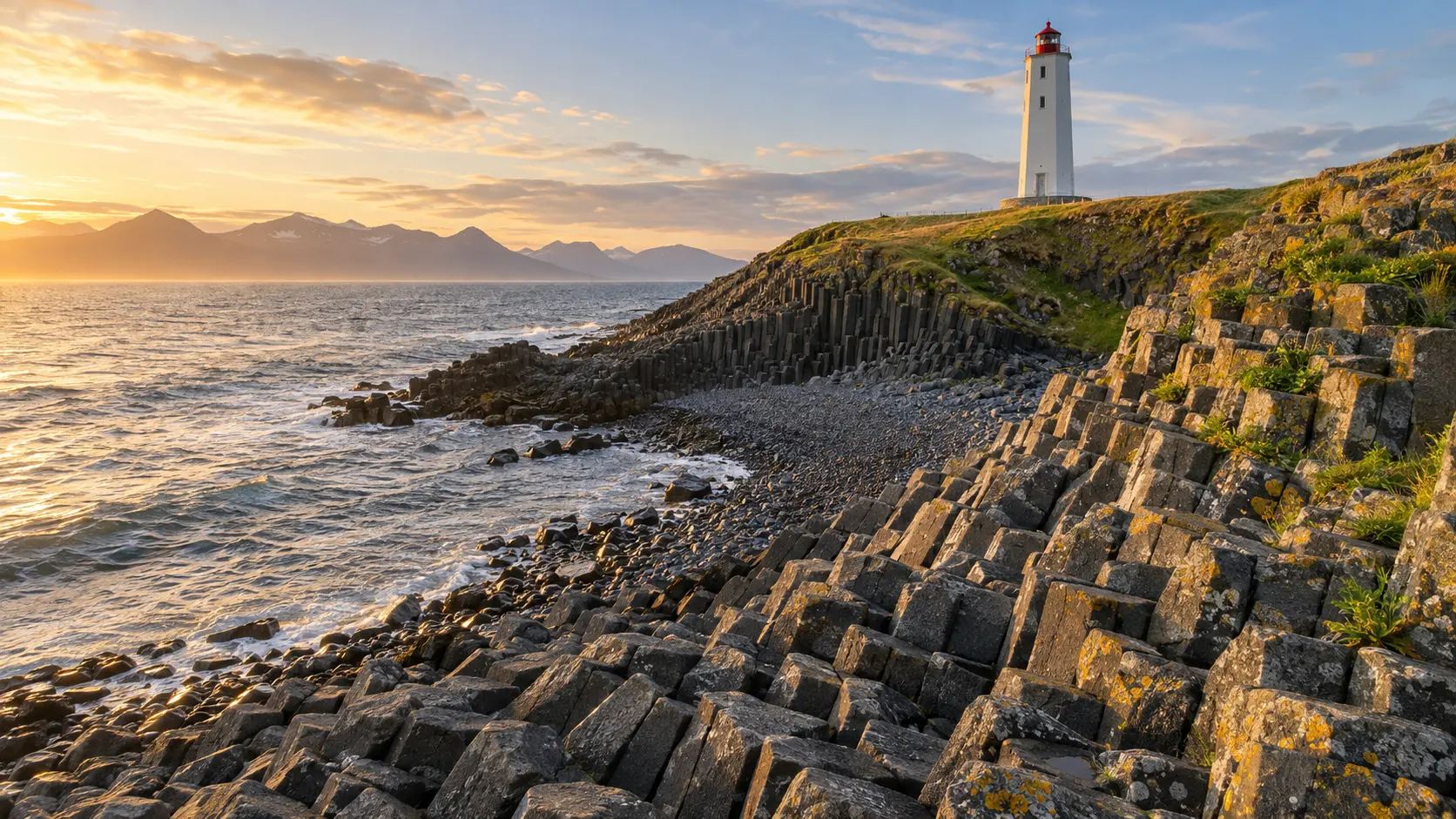
14. Kálfshamarsvík Lighthouse
Arrival plan: drive north from Skagaströnd on gravel Road 745 and take the signed turn to the lighthouse parking and rest area, as described by the Arctic Coast Way guide. Allow 30 to 60 minutes for short exterior walks, staying on the paths because the basalt near the water is uneven and slippery.
Choose this detour for geology and a quiet picnic, especially when staying around Skagaströnd, rather than driving across North Iceland solely to collect another tower. Skip the rocky shore in heavy surf and the detour itself if the gravel road is closed or visibility is poor.
Kálfshamarsvík lies on the northern Skagi Peninsula, a short drive north of Skagaströnd but well away from the standard Ring Road pace. Its lighthouse shares the cove with striking basalt columns and traces of a former community.
Come in daylight, use the established parking and paths, and assume exterior access only. The rocky shore can be slick, while fog and wind can erase the comfortable conditions you had an hour earlier.
When to plan an Iceland lighthouse trip
June through early September is the practical window for the complete set, especially Bjargtangar, Dalatangi, and remote northern detours. Long daylight helps, but it does not repair a washed road or make dense fog safe.
Winter travelers should concentrate on Reykjavík, Akranes, and accessible Reykjanes sites after checking live conditions. Pairing those shorter outings with an Iceland hot-springs stop creates a flexible day when weather changes.
What to bring and what to leave alone
- Windproof waterproof layers: lighthouse headlands offer almost no shelter.
- Warm hat and gloves: these earn their space even during summer.
- Offline maps: download the region, but still obey physical closures and signs.
- Binoculars: watch birds and marine life without approaching nests or cliffs.
- Food, water, and a full fuel or battery reserve: remote detours have few services.
Leave lighthouse doors, fences, geothermal ground, bird colonies, and cliff edges alone. Iceland’s best lighthouse experience is not getting inside a tower; it is seeing why a light was needed on that particular coast.
Which route should you choose?
For a Reykjavík afternoon, I’d choose Grótta for a simple coast walk or Akranes when a staffed tower climb matters most. For one full Snæfellsnes day from a local base, I’d prioritize Malarrif/Lóndrangar, then add Öndverðarnes and Skálasnagi only if their final roads and the weather cooperate.
Save Bjargtangar and Dalatangi for a summer itinerary designed around them. That slower plan produces better photographs, safer decisions, and a much more honest feel for Iceland’s working coast.