Dungeon Provincial Park: Bonavista Visitor Guide
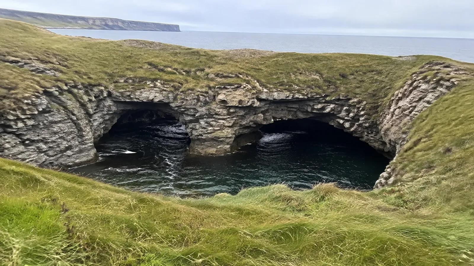
Dungeon Provincial Park is a collapsed sea cave near Bonavista, Newfoundland, not a dungeon, a long hike, or a campground. The experience is simple: park, walk a dirt road across a windy coastal headland, and look into a steep crater where Atlantic waves enter through two openings.
Give it 45 to 90 minutes, stay well back from unprotected edges, and pair it with Bonavista rather than racing across the peninsula for one photo.
Dungeon Provincial Park at a Glance
- Best for: Geology, coastal scenery, photography, birding, and a short Bonavista stop
- Location: Route 238, minutes from the town of Bonavista
- Feature: A roof-collapsed sea-cave system with two openings to the Atlantic
- Time needed: About 45 to 90 minutes for most visitors
- Cost: Free under the current provincial tourism listing
- Camping: Prohibited
- Pets: Welcome on leash under current provincial park guidance
The official tourism listing gives a mid-June through mid-October season, but dates and practical access can change with weather and maintenance. Confirm current notices before building the day around the site.
What Is the Dungeon?
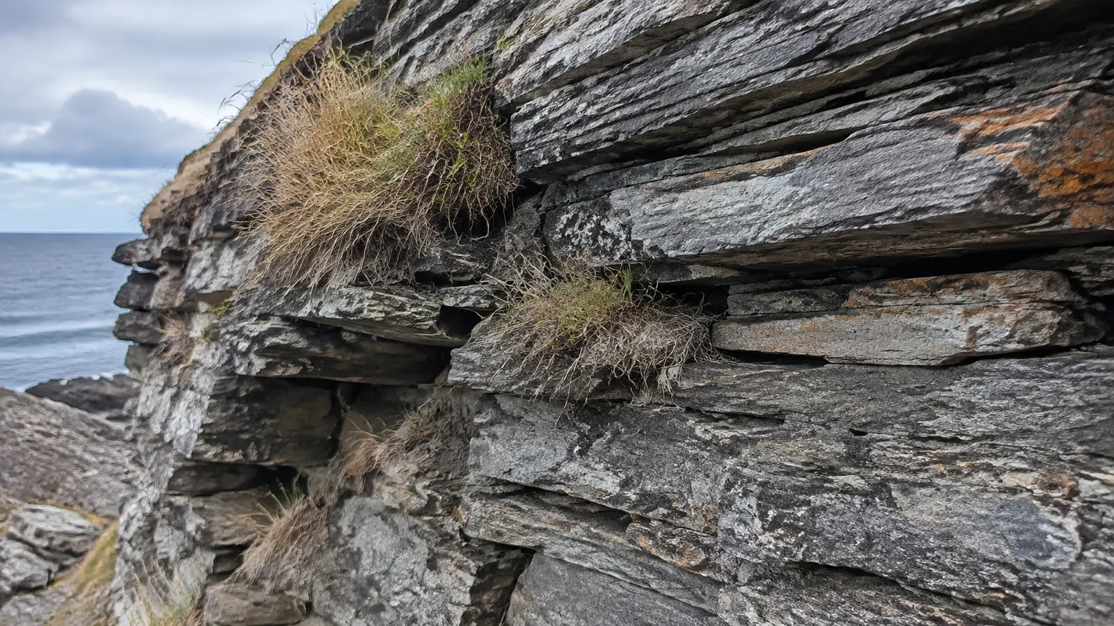
ParksNL describes the Dungeon as a massive, roughly heart-shaped crater with two openings to the sea. It began as separate sea caves eroded into sedimentary rock, which widened, connected, and eventually lost the roof that once supported the land above.
The result is also called a gloup or blowhole, although the experience is closer to looking into a collapsed coastal chamber than watching a predictable geyser. Waves continue to reshape the rock, and the province notes that the remaining caves will eventually erode into sea arches and then a sea stack.
That ongoing change is the whole story. The Dungeon is not a frozen monument, so an old photograph should not be used to judge today’s edge, ground, wave action, or access.
Is Dungeon Provincial Park Worth It?
Yes, especially if you are already staying in Bonavista or driving the Discovery Trail. The park delivers unusual geology and a huge ocean view with little time commitment, no admission fee, and no need for a guided tour.
It is less convincing as a stand-alone day trip from far away. Fog can erase the horizon, wind can make the stop uncomfortable, and the feature itself is one concentrated viewpoint rather than a half-day attraction.
Go If You Like
- Coastal geology that is easy to see without a technical hike
- Short outdoor stops with plenty of room to slow down
- Moody weather, seabirds, open headlands, and wave photography
- Adding one memorable natural site to a Bonavista history day
Skip or Postpone If
- Strong wind or poor visibility makes the approach unsafe
- Your group cannot reliably stay back from steep coastal edges
- You need a guaranteed step-free, firm-surface route
- You expect restrooms, food service, shelter, or a staffed visitor center
ParksNL currently lists parking and cell service, but it does not list a developed slate of visitor facilities. Use Bonavista for restrooms, food, water, and a weather backup rather than assuming they will be available at the viewpoint.

Getting There and Parking
The provincial listing places the park on Route 238 at 48.66683, -53.0842, just outside Bonavista. Download the location before leaving town and follow official directional signs rather than a social-media pin dropped beside the cliff.
Newfoundland and Labrador Tourism lists parking and identifies the attraction as free. ParksNL says visitors can park and stroll a dirt road through green fields to the viewing area.
That description matters because “short walk” does not mean pavement, level ground, or a route suitable for every mobility device. Rain can soften dirt, grass can hide holes, and coastal wind adds effort even when the distance looks easy.
Drivers should use the designated parking area and keep roads, gates, and field access clear. The fences and livestock are not decoration, so do not open gates, approach animals, or turn a pull-off into an improvised parking space.
How Long to Spend
Plan 45 minutes for the walk, viewpoint, and a few photographs in decent weather. Allow up to 90 minutes if you enjoy watching waves, scanning for birds, or waiting for the light to change.
Do not assign a tight 15-minute slot between reservations. A slow vehicle, fog bank, muddy path, or busy parking area can turn an easy stop into an unnecessary rush.
The Dungeon itself is not a formal long-distance hike. Travelers looking for a real coastal walk can add the nearby Cape Shore Trail instead of wandering beyond the recognized park approach.
Edge and Ocean Safety
The most serious hazard is the edge, not the walking distance. Rock and soil can be undercut, wet grass can be slick, and a sudden gust can change your balance before you have time to react.
Stay at the recognized viewing area, obey barriers and signs, and keep children beside an adult. Never step backward for a photograph, sit with legs over an edge, or assume a patch of grass proves solid ground underneath.
Keep pets leashed with the leash in your hand, not tied to gear. ParksNL specifically warns visitors to use extra care with dogs near the Dungeon’s edge.
There is no safe reason to climb down into the formation. Waves surge through the openings, falling debris is possible, and the cliffs are not a route just because somebody else crossed them online.
Weather Changes the Visit
Bonavista weather can shift from bright to foggy, wet, and windy within the same sightseeing block. Check the local forecast, then reassess at the parking area because the headland may feel much harsher than town.
A waterproof shell is more useful than an umbrella in strong wind. Wear shoes with grip, carry a warm layer even in summer, and protect camera equipment from spray and fine rain.
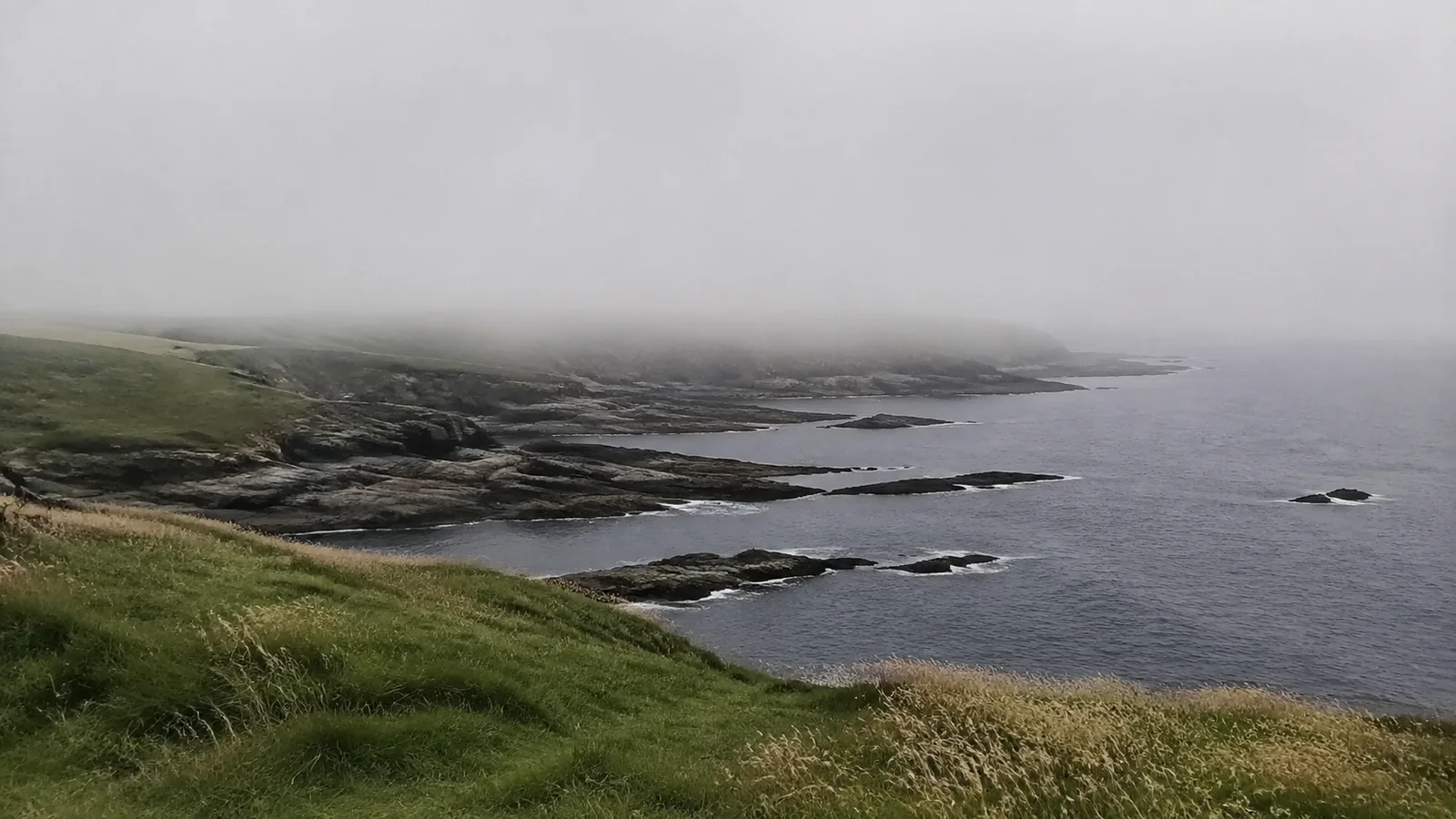
Fog does not make the geology disappear, but it can obscure edges and traffic. If visibility is poor enough that you cannot confidently read the ground ahead, save the stop for later.
Best Time of Day
Morning often fits neatly before Bonavista’s museums and historic sites open, while late afternoon can provide warmer light and fewer itinerary conflicts. Neither time guarantees calm wind, clear skies, whales, puffins, or icebergs.
Avoid timing the entire visit around sunset unless you are prepared for a dark return on the dirt road. Carry a light, keep a warm layer in the car, and know when twilight ends.
Wave action can look more dramatic in rough conditions, but bigger spray is not an invitation to move closer. Let a longer lens create the drama while you keep the same conservative distance.
Photography Without Risk
The most useful lens is often wider than expected because the crater, openings, and ocean need context. A phone can capture that scale if you clean sea mist from the lens and keep both feet planted before composing.
Photograph from several safe angles around the recognized viewing space rather than chasing the single overhead shot copied across social media. Including the grassy bluff or a small person at a safe distance can communicate scale better than leaning over.
Secure loose straps, hats, and lightweight tripods before the wind does it for you. Do not launch a drone without confirming current federal aviation rules and park restrictions for the exact location.
Wildlife Watching
Seabirds pass along the headland, and marine wildlife may appear offshore, but this is not a scheduled performance. Bring binoculars, scan patiently, and treat any whale, puffin, or iceberg as a bonus.
ParksNL points visitors toward Cape Bonavista Lighthouse and the Elliston puffin site for more deliberate puffin viewing. Even there, wildlife presence, distance, weather, and visibility vary.
Never cross fences, approach nests, play bird calls, or feed wildlife for a closer image. The quiet observer usually sees more and does less harm.
Can You Camp at Dungeon Provincial Park?
No. Camping and campfires are prohibited, along with hunting, removing natural objects, cutting trees, and using off-road vehicles or snowmobiles.
The short grass and sunset may look made for a tent, but this is a protected scenic attraction rather than a campground. Choose a legal campground or accommodation and leave before the day visit turns into an unauthorized overnight.
For a provincial campground on the Bonavista Peninsula, ParksNL identifies Lockston Path near Port Rexton and Trinity as a base for regional attractions. Verify dates, availability, campsite type, and driving time separately before committing.
Accessibility and Traveler Fit
The official description includes a dirt-road walk but does not make a broad accessibility promise. Travelers who need a firm surface, close parking, seating, or edge protection should contact ParksNL for current, specific details.
A companion can scout the approach, but nobody should pressure another traveler into uneven or exposed terrain. Cape Bonavista and the town offer alternative coastal views if the Dungeon route does not work that day.
This stop can also be overwhelming for a child who runs impulsively or a dog reactive to livestock. A beautiful free attraction is still the wrong choice when the group cannot manage its main hazard.
Pair the Dungeon With Bonavista
The strongest plan treats the park as one piece of a Bonavista day. Begin at the Dungeon, return to town for food and services, then choose the lighthouse, a historic site, or a coastal walk based on weather.
Cape Bonavista Lighthouse Provincial Historic Site dates to 1843 and preserves a seal-oil-fueled catoptric light apparatus in its tower. Its seasonal admission, opening dates, and interior access are separate from the free provincial park.
The Cape Shore Trail is currently listed as an easy-to-moderate 4.3-mile return coastal route. Add it only when time, footwear, visibility, and energy support a proper hike rather than squeezing it between meal reservations.
Mockbeggar Plantation adds community and political history, while central Bonavista supplies cafés, shops, and working-harbor atmosphere. Seasonal hours vary widely, so choose one indoor priority instead of assuming every door stays open late.
Build a Bonavista Peninsula Trip
The Dungeon belongs within a wider Newfoundland and Labrador itinerary, not a province-wide checklist completed from one hotel. The Newfoundland and Labrador planning guide helps separate the island of Newfoundland from Labrador and organize the long transport legs.
If you are linking multiple provinces, use the Canada road trip framework to price ferries, one-way rentals, fuel, and realistic driving days. Canada’s map makes Atlantic distances look friendlier than they feel after stops and weather delays.
For the Cape Shore Trail or another overnight route, first be clear about the difference between day hiking and backpacking. The Dungeon visit itself requires neither camping equipment nor a heavy pack.
What to Bring
- A waterproof, wind-resistant outer layer
- Closed shoes with reliable grip
- Water and a snack purchased in town
- Binoculars for seabirds and offshore wildlife
- A charged phone, downloaded map, and small flashlight
- A leash and waste bags if bringing a dog
Leave the picnic blanket in the car when wind or wet ground makes it impractical. The best packing decision is the one that keeps hands free and attention on the terrain.
Bottom Line
Dungeon Provincial Park is one of those rare stops where the geology is more interesting than the nickname. Its collapsed caves, twin sea openings, and open Bonavista headland reward an hour, especially when paired with the lighthouse or a coastal trail.
Park where directed, walk the dirt approach, and stay far enough back that the photograph never becomes the dangerous part of the day. If wind or fog removes that margin, Bonavista will still be there while you wait for a better window.