Best Southern Wisconsin Hikes: 8 Trails by Trip Style
Southern Wisconsin hiking is far more dramatic than its polite farmland first suggests. Within a few hours of Madison or Milwaukee, you can climb quartzite bluffs, follow cool sandstone canyons, wander over glacial ridges, and watch two huge rivers meet below your boots.
The best southern Wisconsin hikes at a glance
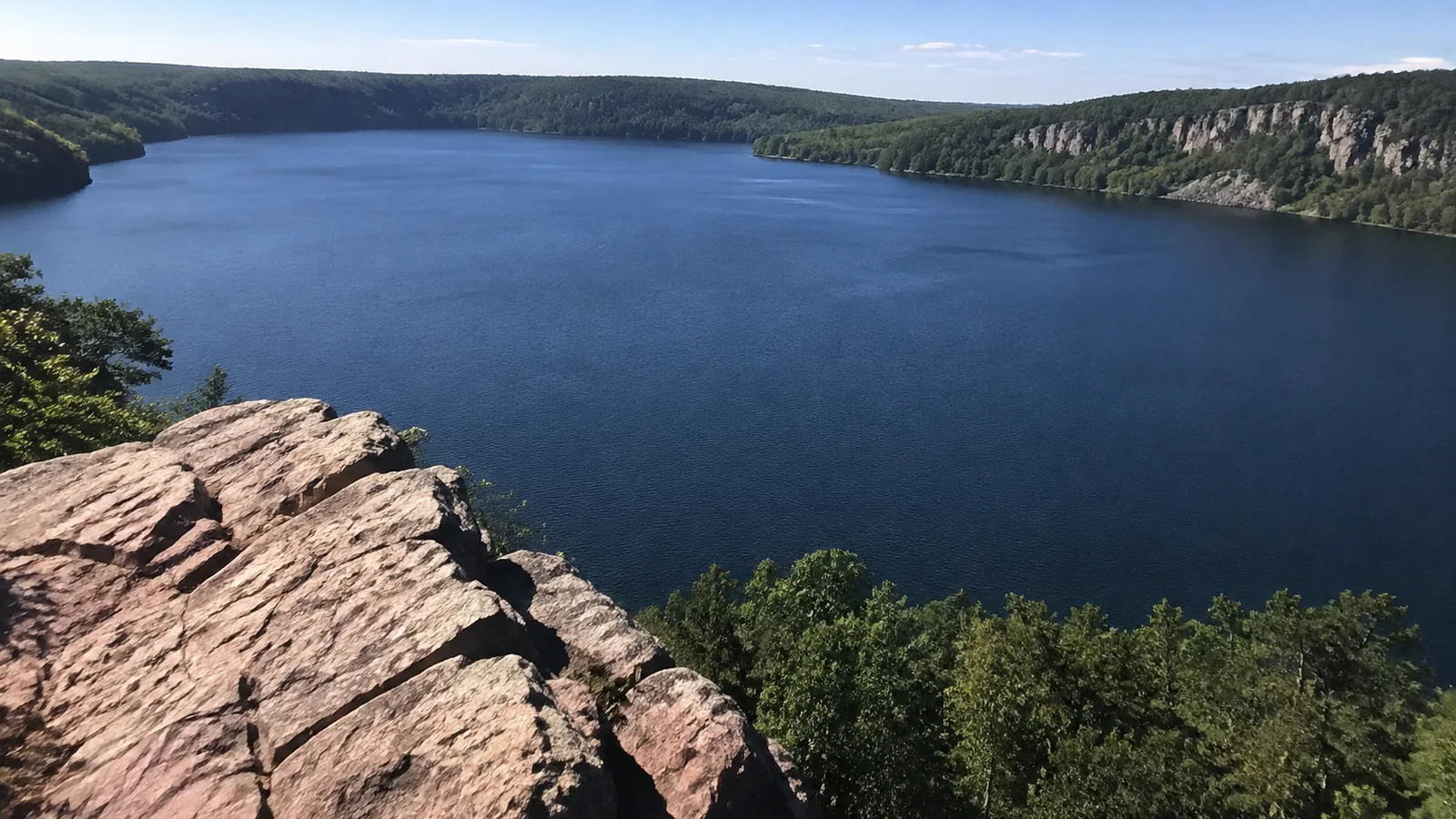
Devil’s Lake has the biggest scenery, Governor Dodge combines a waterfall with longer woodland loops, and Wyalusing delivers the grandest river view. Kettle Moraine is the best all-around choice near Milwaukee, while Blue Mound works beautifully when you want a shorter, quieter walk.
These are not eight interchangeable trails, which is exactly why this list is useful. Pick by difficulty, driving time, weather, and the kind of day you actually want rather than chasing the most photographed rock in the state.
- Best first hike: West Bluff Trail at Devil’s Lake
- Best difficult climb: East Bluff, Balanced Rock, and Devil’s Doorway
- Best gorge walk: Parfrey’s Glen
- Best waterfall pairing: Stephens’ Falls and Lost Canyon
- Best forest loop: Scuppernong’s Orange Loop
- Best near Milwaukee: Lapham Peak
- Best Mississippi River view: Sentinel Ridge at Wyalusing
- Best gentler option: Flintrock Trail at Blue Mound
1. West Bluff Trail at Devil’s Lake
Best for: A classic first look at Wisconsin’s bluff country.
West Bluff earns its popularity with broad lake views, rocky overlooks, and enough elevation to feel like a real hike. The trail is short enough for a half-day but steep and uneven enough that sneakers with smooth soles are a miserable bargain.
Start early on warm weekends because parking, beaches, and bluff trails become crowded. The Wisconsin DNR’s Devil’s Lake crowd guidance identifies West Bluff, East Bluff, Tumbled Rocks, Balanced Rock, and Devil’s Doorway among the busiest trails and areas.
West Bluff is my pick for a first-time visitor who wants the famous view without choosing the steepest possible ascent. Add the mostly level Tumbled Rocks shoreline path if your legs still feel cheerful afterward.
2. East Bluff, Devil’s Doorway, and Balanced Rock
Best for: Iconic formations and a tougher stair-filled workout.
East Bluff gives you access to the park’s best-known rock formations, but your exact route matters. Balanced Rock involves a steep stone staircase, while other connectors let you reach the bluff top with a less direct but still substantial climb.
Do not treat a short mileage number as proof that this hike is easy. Heat reflects off exposed rock, steps become slick in rain, and there are real drop-offs near viewpoints.
Build your loop with the current park map, and turn around before fatigue makes the descent clumsy. The best bluff day ends with lake views and an ice cream, not an improvised rescue from a ledge.

3. Parfrey’s Glen
Best for: A cool ravine that feels completely different from the nearby bluffs.
Parfrey’s Glen is a 1.6-mile round trip into Wisconsin’s first State Natural Area. Floods destroyed the old boardwalk and bridges, so today’s route includes a rocky creek bed and one shallow stream crossing rather than a neat wooden promenade.
The official Parfrey’s Glen visitor page also says hikers may not continue beyond the waterfall. Stay within the allowed area, keep food and pets elsewhere, and expect wet feet when water is up.
This is not the right choice for a stroller, flip-flops, or anyone who needs a smooth accessible surface. It is lovely for careful hikers who enjoy texture, shade, and the sound of water more than a summit view.
4. Stephens’ Falls and Lost Canyon at Governor Dodge
Best for: A flexible waterfall stop with an optional three-mile loop.
Stephens’ Falls Trail is a half-mile outing past rock outcrops, ferns, stream, and waterfall. A paved quarter-mile path reaches an overlook above the falls, although descending to the lower trail requires stone steps and uneven ground.
For a fuller hike, connect to the three-mile Lost Canyon loop, which has several steep grades through mostly wooded terrain. The DNR’s Governor Dodge trail descriptions make it easy to compare that route with Mill Creek, Meadow Valley, and the lake trails.
This is my favorite recommendation for a mixed group because one person can enjoy the overlook while stronger hikers continue. Waterfall flow changes with rain and season, so arrive for the landscape rather than expecting a fixed performance.
If waterfalls are the whole point of your drive, the northern Wisconsin waterfall route offers a longer adventure with a very different scale. Governor Dodge is the easier southern add-on for a Madison weekend.
5. Scuppernong Trail System in Kettle Moraine
Best for: Rolling woods, choose-your-own mileage, and a satisfying workout near Milwaukee.
Scuppernong has three color-coded loops through hardwood forest and pine plantations. The red loop is 2.3 miles, orange is 4.1 miles, and advanced green is 4.9 miles, with hills that feel much more energetic than the map suggests.
The DNR’s Kettle Moraine hiking page lists parking, water, and a vault toilet at the trail area, but availability can change seasonally. Carry your own water anyway and download the current map before leaving cell service.
Orange gives most day hikers the best balance of distance and forest immersion. Red is not automatically easy just because it is shortest, since the official description notes steep terrain.
The surrounding Southern Unit covers more than 22,000 acres, so Scuppernong is only one doorway into it. This is a natural extension to a Wisconsin road trip when you would rather collect trail miles than town souvenirs.
6. Lapham Peak and the Ice Age Trail
Best for: Glacial terrain within an easy drive of Milwaukee.
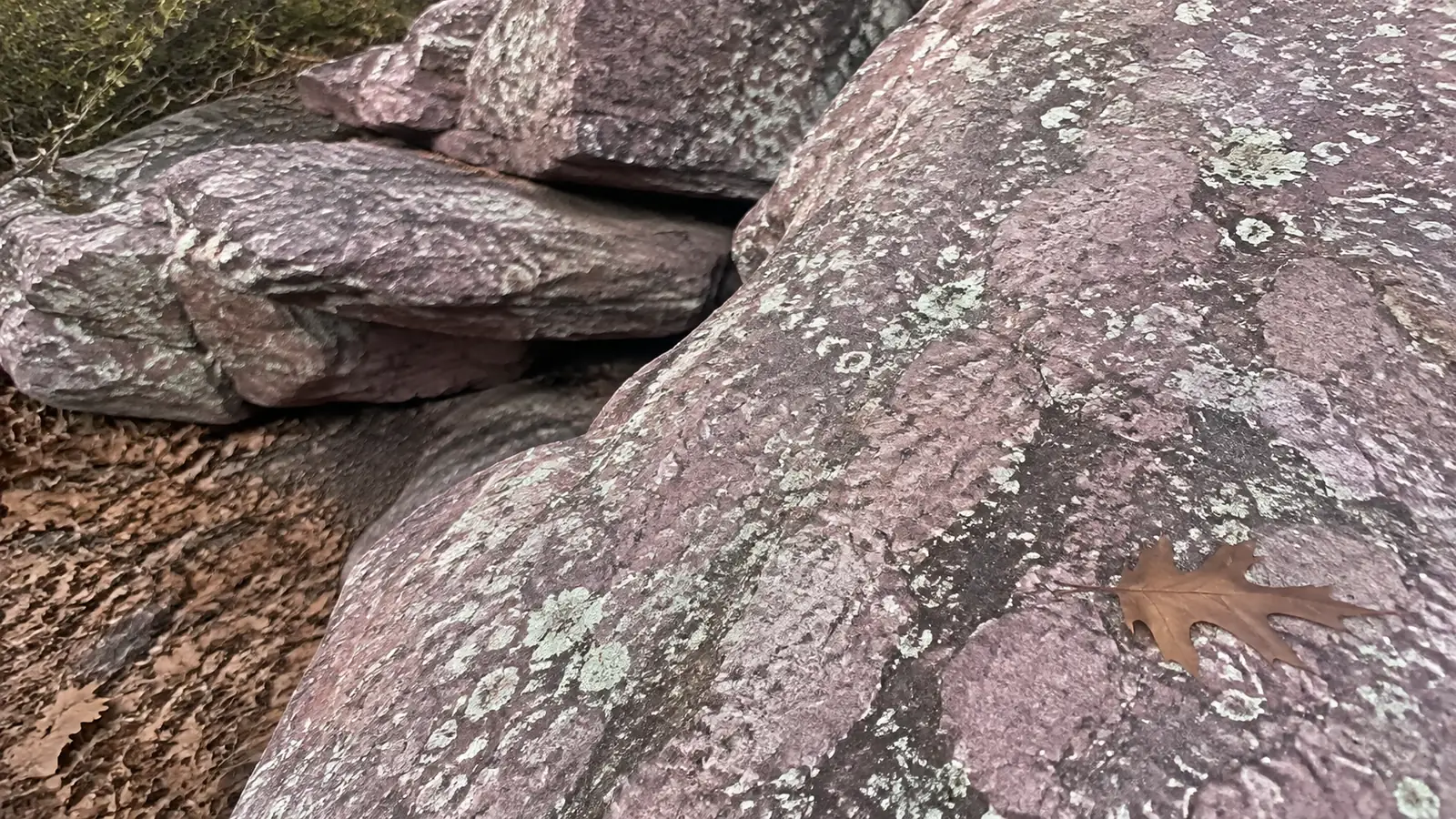
About four miles of the Ice Age National Scenic Trail cross the Lapham Peak Unit, and shorter park paths make the day easy to adjust. A 45-foot observation tower sits atop the highest point in Waukesha County, at 1,233 feet above sea level.
Pair a section of the Ice Age Trail with the easy two-mile Kame Terrace Trail for a manageable introduction. More ambitious hikers can build a hillier loop, but winter brings groomed ski routes and activity-specific restrictions that change where hikers should walk.
This is also a good place to understand how Wisconsin’s glacial landscape was made. Kames, kettles, ridges, and rolling moraines turn what looks like modest elevation on paper into a surprisingly lively trail.
7. Sentinel Ridge at Wyalusing State Park
Best for: Huge views over the Mississippi and Wisconsin river confluence.
Wyalusing’s bluffs rise about 500 feet above the rivers, and the 1.6-mile Sentinel Ridge trail and loop moves from Point Lookout toward the boat landing. Its ridge section includes interpretive information and a level portion, but the route later drops steeply toward the Mississippi River.
The official Wyalusing hiking guide warns that bluff trails include steps and can become slippery with rain, leaves, loose gravel, or ice. Stay back from edges and give children close supervision even when the view is begging for one more photo.
Wyalusing is farther from Milwaukee than the Kettle Moraine choices, but it feels like a destination rather than an after-work loop. Give it a full day, bring a picnic, and add Sand Cave only if time and footing are both on your side.
8. Flintrock Trail at Blue Mound
Best for: A quieter, shorter walk with geology along the way.
Flintrock is a 1.3-mile self-guided woodland trail with interpretive signs and scattered chert boulders. It sits on the north side of the mound and offers a calmer alternative to Devil’s Lake’s headline routes.
Blue Mound is the highest point in southern Wisconsin, and the wider park contains more than 20 miles of trails. If Flintrock feels too brief, add the one-mile Pleasure Valley route or its one-mile Weeping Rock extension.
The easiest park route is the one-mile John Minix loop, which is useful for beginners and families. For a bigger skills overview before choosing mileage, this explanation of hiking as both a hobby and a sport sorts out effort, training, and pace without gatekeeping.
When to hike southern Wisconsin
Late spring brings waterfalls and fresh green, but mud, ticks, and high creek water can complicate plans. Summer offers long days and full services, along with heat, humidity, crowds, mosquitoes, and exposed-rock conditions that can become punishing by afternoon.
Fall is the showstopper, particularly around bluff overlooks, but popular parking lots can fill early. Fallen leaves hide roots and make stone steps slippery, so bright color does not cancel ordinary trail caution.
Winter can be beautiful on designated hiking and snowshoeing routes, yet ice changes the difficulty completely. Some trails become ski-only when snow-covered, and unplowed State Natural Area access can disappear after storms.
Parking, passes, pets, and trail rules
Many Wisconsin state parks and forests require a vehicle admission sticker, while certain trails or uses can require separate passes. Buy the correct admission for your date and vehicle rather than assuming a parking fee covers every activity.
Pets are welcome in many designated state park areas when leashed, but not everywhere. Parfrey’s Glen and Gibraltar Rock prohibit pets, and beaches, buildings, picnic zones, or sensitive areas can have their own rules.
State Natural Areas often have few facilities, rough access, and stricter protections than developed parks. Do not collect rocks, plants, fossils, or artifacts, and never launch a drone where prohibited.
What to pack
- Grippy hiking shoes suitable for wet stone and roots
- More water than a short trail seems to deserve
- Sun protection, insect repellent, and a tick-removal tool
- A downloaded official map plus a charged phone
- A light rain layer and an insulating layer in cooler months
- Snacks only where food is permitted
- Traction suitable for ice when winter conditions warrant it
Check for ticks after every warm-season hike, including hairline, waistband, and behind knees. If you are deciding between an overnight and a day outing, this practical comparison of backpacking and hiking explains the very different planning burden.
Southern Wisconsin hiking FAQs
What is the best hike in southern Wisconsin?
West Bluff at Devil’s Lake is the best single recommendation for a fit first-time visitor because the scenery arrives quickly and feels distinctly Wisconsin. Stephens’ Falls is better for mixed abilities, while Wyalusing wins for river views.
Are these hikes beginner-friendly?
Several are, but Devil’s Lake bluff routes and longer Kettle Moraine loops demand more stamina and careful footing. Beginners should start short, use the official map, and save a second trail for another day.
Can I hike with my dog?
Dogs are allowed on many state park trails when leashed, but property-specific restrictions matter. Do not take a dog to Parfrey’s Glen or Gibraltar Rock, and verify the latest pet map before every trip.
Do I need hiking boots?
Supportive trail shoes with good grip are enough for many routes in dry weather. Boots can help on wet, rocky, muddy, or winter trails, but fit and traction matter more than the label on the footwear.
Choose an exact route before leaving home
The distances below describe specific walks, not every possible connection within the park. Times are my planning allowances with short breaks, and cumulative ascent is marked unpublished where the official trail description does not provide a reliable total; steep terrain should never be interpreted as flat simply because an ascent number is absent.
- Hike and start: West Bluff, Devil’s Lake North Shore parking
- Route and distance: West Bluff plus Tumbled Rocks and shoreline connections, roughly three-mile loop
- Time and climbing: 2–3 hours; about 500 feet from lake level to bluff, with additional ups and downs
- Easier choice: Short out-and-back on the shoreline, turning before steep sections
- Hike and start: East Bluff/Devil’s Doorway, North Shore parking
- Route and distance: East Bluff and East Bluff Woods loop plus the Doorway spur, roughly 3.2 miles
- Time and climbing: 2.5–3.5 hours; roughly 500-foot bluff rise, cumulative gain higher
- Easier choice: South Shore’s level Grottos Trail
- Hike and start: Parfrey’s Glen, signed lot off County DL
- Route and distance: 0.7 mile each way, about 1.4 miles return
- Time and climbing: 1–1.5 hours; cumulative gain unpublished, with uneven streamside footing
- Easier choice: Turn around along the lower approach
- Hike and start: Lost Canyon, Stephens’ Falls parking at Governor Dodge
- Route and distance: Three-mile loop, with additional approach if visiting the falls
- Time and climbing: 2–3 hours; cumulative gain unpublished, several steep grades
- Easier choice: Short walk to the falls overlook without the canyon loop
- Hike and start: Scuppernong, County ZZ trailhead
- Route and distance: Red Loop, 2.3 miles
- Time and climbing: 1.5–2 hours; cumulative gain unpublished, rolling and steep sections
- Easier choice: A short return walk from the same trailhead
- Hike and start: Lapham Peak, Homestead Hollow
- Route and distance: Pine Grove Path, 1.8-mile paved loop
- Time and climbing: 1–1.5 hours; cumulative gain unpublished, gentler than the ridge system
- Easier choice: Shorten the paved outing before committing to the full loop
- Hike and start: Sentinel Ridge, Point Lookout parking at Wyalusing
- Route and distance: Full trail toward the boat landing is listed at 1.6 miles; return the same way for about 3.2 miles
- Time and climbing: 2–3 hours; cumulative gain unpublished, major descent then climb back
- Easier choice: The upper interpretive loop, avoiding the river descent
- Hike and start: Flintrock, Blue Mound summit-area parking
- Route and distance: Signed 1.3-mile nature loop
- Time and climbing: 1–1.5 hours; cumulative gain unpublished, uneven north-slope terrain
- Easier choice: John Minix, the park’s easier one-mile loop
Balanced Rock is a separate, steep access option from the south: the DNR lists that climbing trail at 0.4 mile and Devil’s Doorway at 0.1 mile. If you want both, start at South Shore, climb Balanced Rock to East Bluff, visit the Doorway spur, and retrace the signed route, budgeting roughly 1.5 to 2 miles including the parking approach and two hours; do not add this descent to the North Shore loop without mapping the return.
For Lapham Peak, the table deliberately selects Pine Grove Path as the manageable first visit, while the seven-mile Moraine Ridge route is a separate longer choice from Evergreen Grove. Check the official Lapham trail descriptions and the Scuppernong loop options so the color and trailhead on your map match the walk you intend to take.
Final thoughts
Southern Wisconsin rewards hikers who choose for the day in front of them. Start with one trail that suits your group, check the official conditions that morning, and leave enough time to enjoy the overlook instead of racing back to the parking lot.
Devil’s Lake may earn the first visit, but the cooler canyons, glacial woods, quiet mounds, and enormous river horizons are what make a second weekend inevitable. That variety is the real magic of hiking here.