Outer Banks Road Trip: Lighthouses, Beach Towns, and Ferry Stops
The Outer Banks is a road trip where the map looks beautifully simple until the Atlantic, Pamlico Sound, ferry schedules, bridge traffic, and one very long ribbon of Highway 12 start making most of the decisions for you.
I would give the barrier islands at least six days, move from the northern beaches toward Hatteras and Ocracoke, and leave enough flexibility that a windy ferry day or ocean-overwash closure does not unravel the whole vacation.
The Six-Day Outer Banks Route
- Day 1: Corolla and the northern beaches
- Day 2: Kitty Hawk, Kill Devil Hills, and Nags Head
- Day 3: Bodie Island and the drive south on Hatteras Island
- Day 4: Cape Hatteras, Buxton, and Hatteras Village
- Day 5: ferry to Ocracoke
- Day 6: Ocracoke and your return or mainland ferry
I would use three bases rather than changing hotels every night: the northern Outer Banks, Hatteras Island, and Ocracoke. The islands are linear enough that staying in the right region saves far more time than chasing the cheapest room.
If you love lighthouse-heavy coastal trips, my Maine coast road trip gives you a much rockier northern version. The Outer Banks is flatter, sandier, and far more dependent on one vulnerable coastal highway.
Day 1: Corolla and the Northern Beaches
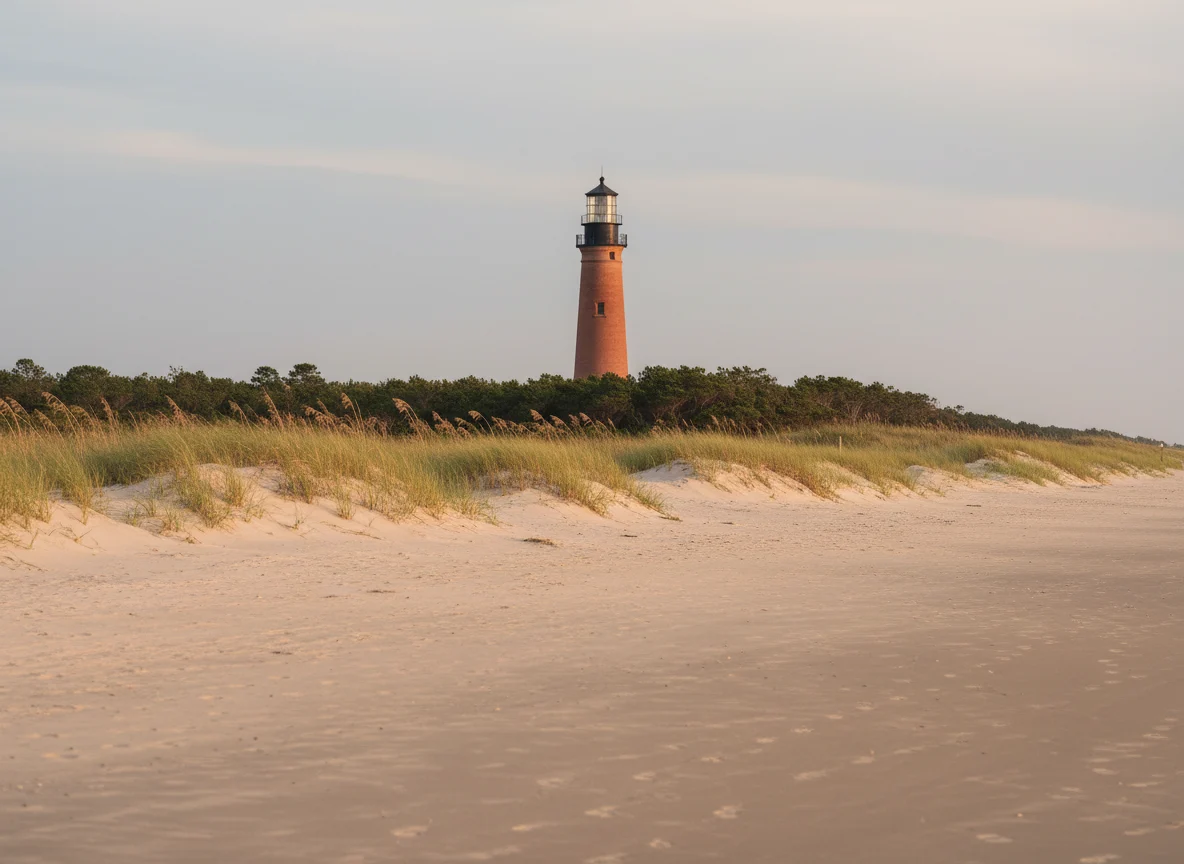
Start at the northern end if you are arriving from Virginia or the main Outer Banks bridges. Corolla has beaches, historic sites, and a quieter feel than the central towns farther south.
Do not drive onto the beach casually
Some northern Outer Banks areas allow four-wheel-drive beach access under specific local rules, but that is not the same thing as a normal scenic road. Vehicle requirements, parking permits, tire pressure, tides, and seasonal restrictions can all matter.
If you want a beach-driving or wild-horse experience, use current local guidance or an established tour rather than assuming a rental SUV belongs on deep sand. Rental-car contracts may also prohibit off-pavement driving even where local law allows it.
Stay somewhere you can walk after dinner
Corolla or Duck works well if you want a polished first-night base, while Kitty Hawk or Kill Devil Hills offers a broader range of lodging. I would choose based on tomorrow’s first stop rather than driving south just to save a little on the room.
Day 2: Kitty Hawk, Kill Devil Hills, and Nags Head
Use today for the central Outer Banks, where history, beaches, restaurants, and easier services are concentrated. This is also the best day to stock the car before you move farther south.
Wright Brothers National Memorial
The Wright Brothers National Memorial is the major history stop I would protect in this part of the trip. Check the National Park Service for current hours, fees, programs, and weather-related information before arrival.
Give the site enough time to walk the grounds and understand why this windy stretch of sand mattered. It is much more interesting than taking one photo of the monument from the parking lot.
Jockey’s Ridge
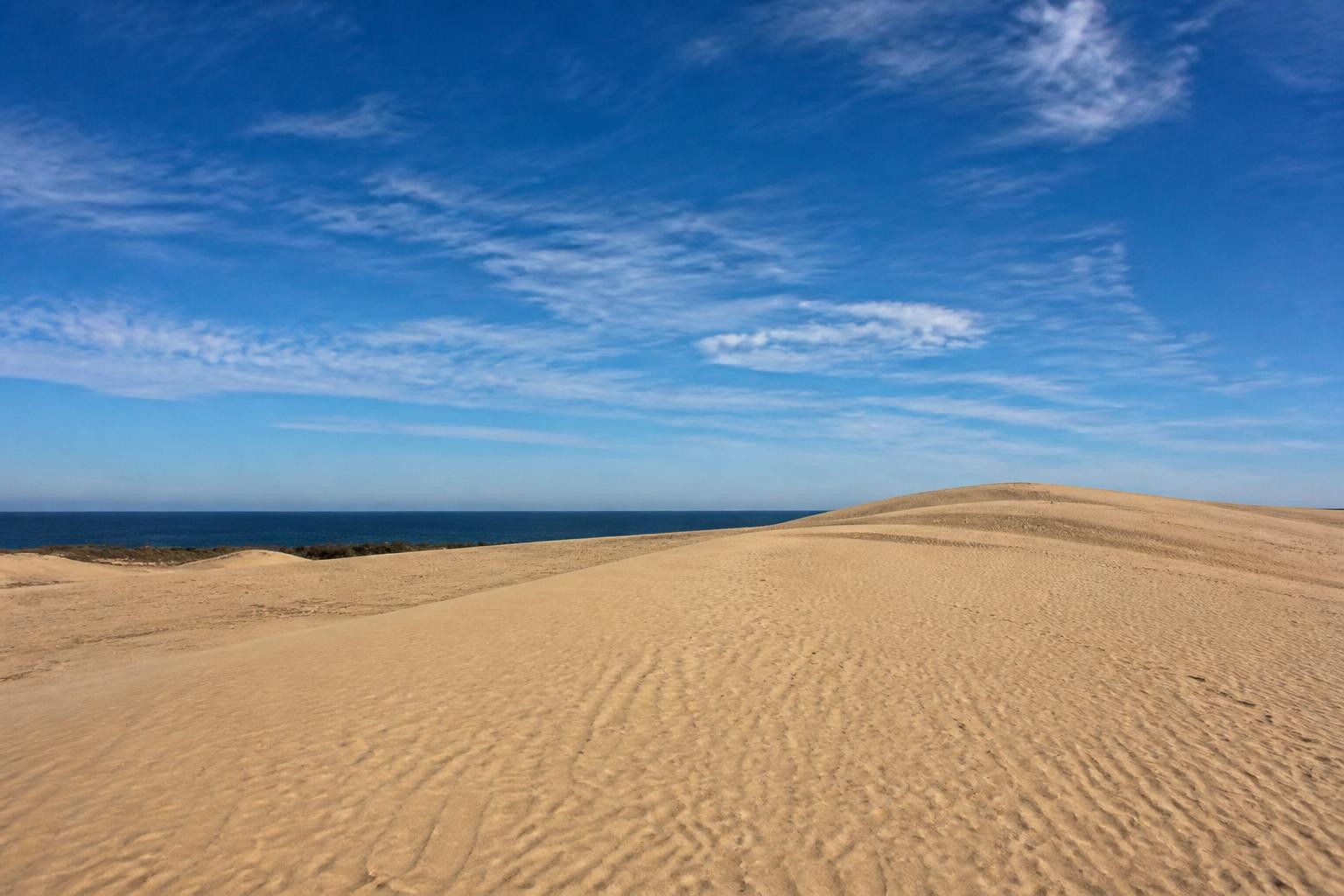
Jockey’s Ridge State Park gives you a completely different kind of Outer Banks landscape with huge dunes and broad views. Go earlier or later in hot weather because exposed sand can become brutally warm.
Stay around Nags Head
Nags Head positions you perfectly for Bodie Island and the beginning of Cape Hatteras National Seashore tomorrow. Have dinner, fuel the car, and download anything you need before the route gets longer and quieter.
Day 3: Bodie Island and Highway 12 South
Today is when the road trip really begins to feel like the Outer Banks. Highway 12 threads south through marshes, narrow barrier-island sections, villages, and long stretches where ocean and sound are never very far away.
Bodie Island Lighthouse
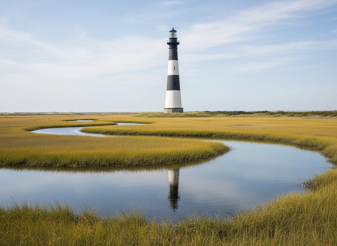
Bodie Island Lighthouse is part of Cape Hatteras National Seashore and makes a natural first stop after leaving Nags Head. The grounds and lighthouse experience are managed by the National Park Service, with climbing access and seasonal operations subject to current conditions.
Check the official Bodie Island page if climbing matters to you. Lighthouse operations can change with weather, maintenance, and season.
Pea Island and the drive south
Continue through Pea Island and across the bridges toward Hatteras Island villages. This is not a day I would overpack with attractions because the road, beaches, birdlife, and changing barrier-island scenery are the experience.
Stop only where parking is legal and safe. Highway 12 can be narrow, and sand or standing water after storms changes driving conditions quickly.
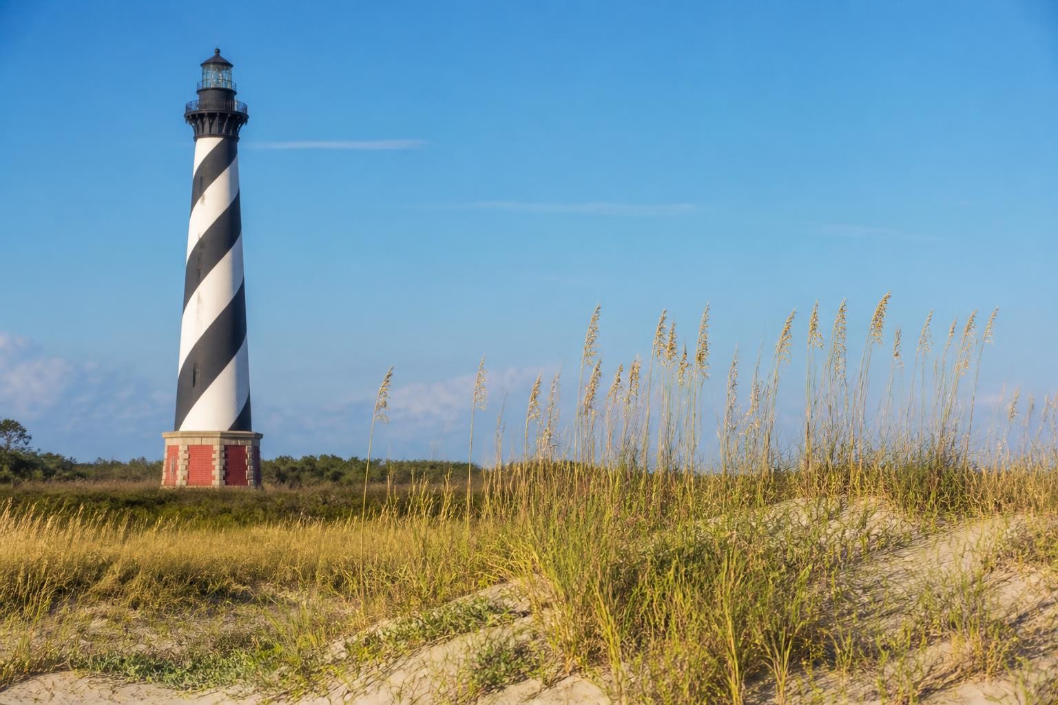
Day 4: Cape Hatteras and Hatteras Village
Spend the day around Buxton, Frisco, and Hatteras Village rather than treating the southern island as the ferry queue for Ocracoke. Beaches, lighthouse history, maritime stories, and small communities can easily fill a full day.
Cape Hatteras Lighthouse
The Cape Hatteras Lighthouse area is one of the signature stops on the islands, but restoration work and visitor access can change over time. Check the National Park Service for the current status of the lighthouse, grounds, climbing, and visitor facilities.
I would still visit the area even when tower access is unavailable. The history of the lighthouse, shoreline movement, and the structure’s relocation tells you a lot about living on a barrier island.
Give Hatteras Village the evening
Stay near Hatteras Village if you plan to ferry to Ocracoke the next morning. That keeps ferry day simple and gives you a quieter waterfront evening instead of another late drive.
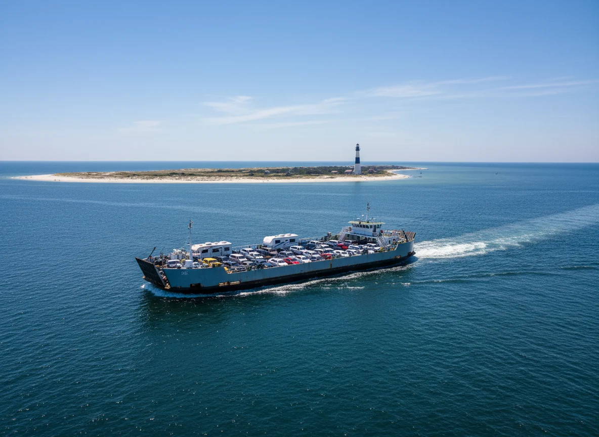
Day 5: Ferry to Ocracoke
Ocracoke is the part of the road trip where you cannot pretend the car controls everything. Ferry operations depend on route, weather, shoaling, vessel availability, traffic, and season.
Check NCDOT before leaving the hotel
The NCDOT Ferry Division is the source I would use for current schedules, reservations where offered, service alerts, fares, and route status. Do not rely on a screenshot from an old travel post for a ferry you need to catch today.
The Hatteras-Ocracoke route is the natural continuation south through the islands, while longer routes from Ocracoke connect to the mainland. Exact schedules and reservation procedures vary by route and season, so verify the trip you actually intend to take.
Give yourself ferry margin
Arrive according to the ferry service’s current instructions and avoid scheduling an inflexible tour immediately after the crossing. Summer traffic and service changes can turn a supposedly simple transition into a much longer part of the day.
Stay on Ocracoke
I would spend the night instead of ferrying over, walking around for two hours, and immediately joining another departure line. Ocracoke is much more appealing once you can park the car and slow down.
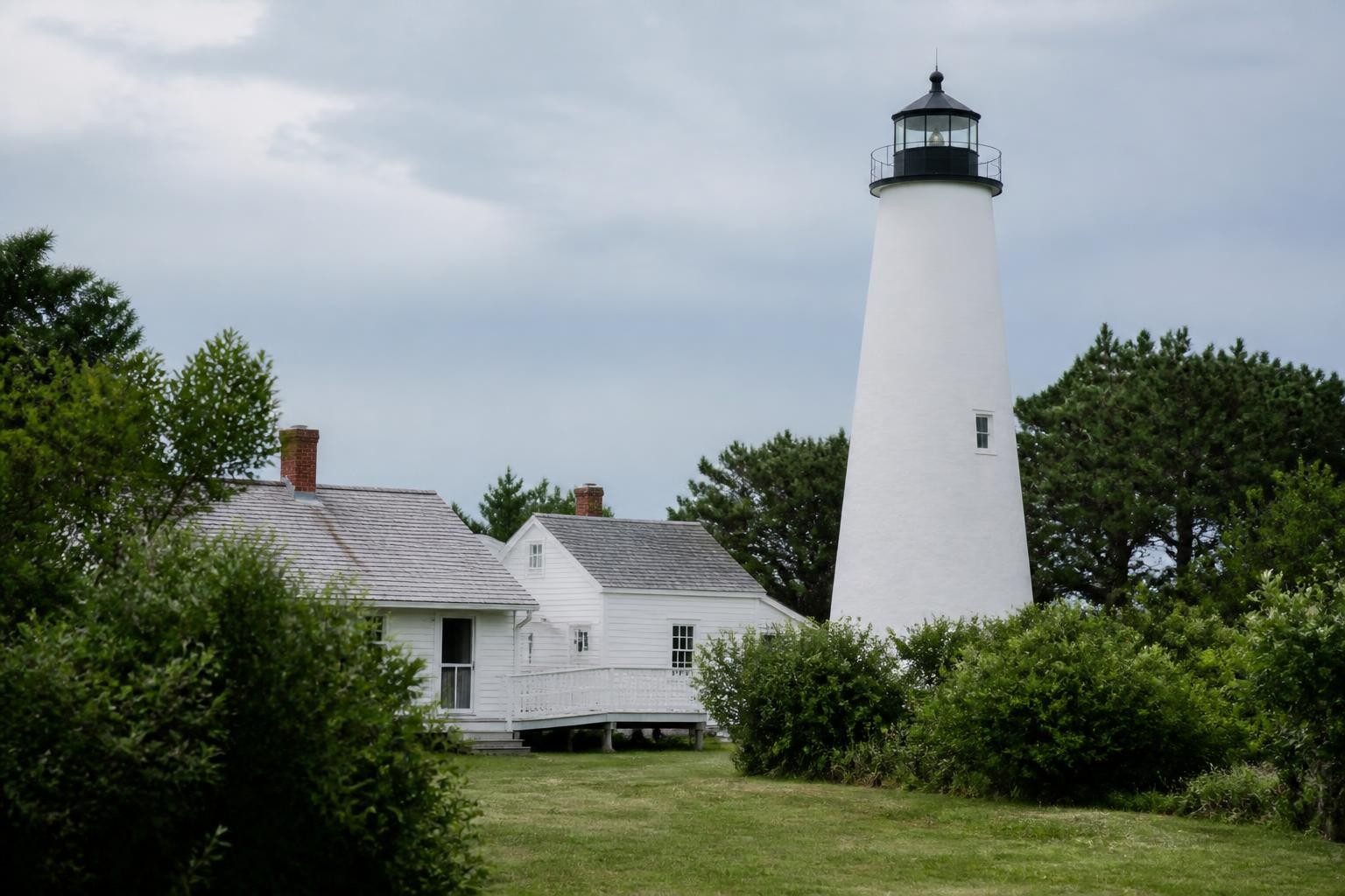
Day 6: Ocracoke
Use the morning for the village, lighthouse, beach, or a short outing before deciding whether you are returning north or taking a mainland ferry. The village is compact enough that bicycles and walking can replace the car for part of the day.
Ocracoke Lighthouse
Ocracoke Lighthouse is part of Cape Hatteras National Seashore and is viewed from the surrounding area rather than approached like a normal climbable tower. Check current NPS access information and respect private property around the site.
Choose your exit route based on the rest of the trip
If your next destination is north on the Outer Banks, return via Hatteras. If you are continuing into mainland North Carolina, one of the longer vehicle-ferry routes may save substantial backtracking.
This is where a one-way route can be much better than retracing every mile. Let your next hotel determine which ferry makes geographic sense.
Highway 12 Can Close
NC Highway 12 crosses extremely vulnerable barrier-island terrain and can close because of ocean overwash, sand, flooding, storms, bridge incidents, or emergency work. During significant coastal weather, access can change quickly.
Check DriveNC and the National Park Service current-conditions information before moving between island sections. If authorities close the road, wait for reopening rather than trying to route through flooded or sand-covered local streets.
Hurricane Season Deserves Real Flexibility
Tropical systems can trigger evacuations, ferry changes, bridge restrictions, park closures, and major flooding. If local or state officials issue evacuation instructions, follow them promptly.
I would choose refundable lodging and travel insurance that fits my risk tolerance for peak hurricane-season dates. No beach-house reservation is worth debating with an evacuation order.
Where I Would Stay
Northern or central Outer Banks: two nights around Duck, Kitty Hawk, Kill Devil Hills, or Nags Head gives you easy access to the northern and central attractions.
Hatteras Island: spend two nights around Buxton, Avon, or Hatteras Village depending on your priorities. Hatteras Village is the most convenient choice before the Ocracoke ferry.
Ocracoke: one night is enough to make the island feel completely different from a ferry stop. Two nights works even better if beach time or a very slow trip is the goal.
Best Time for an Outer Banks Road Trip
Late spring
Late spring can bring warm days before peak summer crowds, though ocean water remains cool and weather is still variable. Seasonal businesses and lighthouse programs may not all operate on full summer schedules.
Summer
Summer gives you the widest range of beach activities and visitor services along with the biggest traffic and lodging demand. Build more time around bridges, ferry lines, and Saturday rental-house turnover traffic.
Early fall
September and early October can be beautiful after the main family-travel rush, but tropical-weather risk remains very real. Keep reservations flexible and watch forecasts.
Winter
Winter is quiet and dramatic, with far fewer services and much less predictable beach weather. I would build a town-and-scenery trip rather than expecting the summer version without crowds.
What to Pack
- Sun protection and beach gear
- Light rain and wind layer
- Small cooler
- Offline maps and ferry confirmations
- Binoculars for birds and wildlife
- Motion-sickness medication if ferries affect you
- Car charger
My road trip tips cover ordinary car preparation. On the Outer Banks, I would put ferry status and Highway 12 conditions much higher on the morning checklist than optimizing the trunk.
Pack for Wind, Sand, and Ferry Days
My road trip packing list is useful here because Outer Banks weather can move quickly between hot beach afternoons, windy ferry crossings, and wet storm days. Keep the rain layer and ferry confirmations easy to reach.
My Favorite Version of the Outer Banks
I would spend two nights around Nags Head, two on Hatteras Island, and one or two on Ocracoke, then leave via whichever ferry best matches the next destination. That turns Highway 12 into the connective thread without requiring you to retrace the entire route.
The Outer Banks is not a road trip I would schedule down to the minute. The ocean already has enough influence over the road, so let the itinerary be the flexible part.