Waterfalls Near Duluth: City Walks and North Shore Day Trips
Duluth is one of those rare cities where a waterfall morning does not require a heroic alarm. Start with creek cascades inside town, then choose between Minnesota’s North Shore and Wisconsin’s state parks when you have a car, a full day, and shoes that can handle wet rock.
Pick Your Best Duluth Waterfall Day
- No long drive: Chester Creek, Tischer Creek, and Amity Creek
- Easy first visit: Gooseberry Falls State Park
- Big waterfall hike: High Falls in Tettegouche State Park
- Wisconsin pair: Amnicon Falls and Pattison state parks
- Quiet city alternative: Miller Creek in Lincoln Park
- Full North Shore day: Gooseberry plus Tettegouche, with fewer extra stops
You can see several city cascades in half a day, but the state parks deserve slower pacing. North Shore miles look easy on a map until overlooks, trail time, construction, weather, and Lake Superior views turn one hour into three.
Before You Go
Duluth’s natural-surface trails should not be used during wet weather or while they are soft and muddy. The city says trails typically need about 24 hours after rain to reopen, and footprints or tire ruts are your cue to turn around.
Check the current Duluth hiking trail guidance, Minnesota DNR park conditions, Wisconsin DNR notices, and 511 road reports on the day you travel. Spring thaw, storm damage, construction, fire response, and ice can change a route faster than an old blog map.
Water volume also changes dramatically. Spring runoff and rain make the falls louder, summer can expose more rock, autumn brings color and crowds, and winter turns ordinary steps into traction-device territory.
Waterfalls Inside Duluth
Chester Creek Cascades
Chester Park follows Chester Creek through Duluth’s East Hillside, giving you a string of bedrock drops rather than one enormous destination waterfall. It is the best fit when you want a real forest-and-water walk without committing to Highway 61.
Begin from an official park access, use the city map, and decide whether you are walking the upper or lower section before setting off. Road crossings, forks, seasonal ski operations, and steep creek-side terrain make “just follow the water” a poor navigation plan.
Allow 60 to 90 minutes for an unhurried section, more if you connect farther along the creek. Stay back from wet ledges, keep children within reach, and do not enter fast water above a drop.
Tischer Creek in Congdon Park
Congdon Park runs along Tischer Creek between roughly 33rd Avenue East and St. Marie Street. The city highlights its bridges, hiking paths, and waterfalls, and the narrow ravine feels surprisingly removed from surrounding neighborhoods.
This is my city pick for visitors who want multiple small cascades and handsome stonework in a compact outing. Parking is neighborhood-sensitive, so use legal spaces, avoid blocking driveways, and leave the loud trailhead gathering for somewhere designed for it.
Do not treat the creek as a swimming hole. Duluth identifies Tischer Creek as impaired for E. coli and chloride, information available through the city’s water resources program.
Amity Creek and Lester Park
Lester Park has more than 9 miles of hiking and mountain-bike trails between Amity Creek and the Lester River. Seven Bridges Road follows Amity Creek, creating several chances to see rushing water without pretending every bedrock drop needs its own invented name.
Choose this area when you want a longer city walk or a scenic drive with short stops. Cyclists, hikers, skiers, vehicles, and neighborhood traffic may share parts of the broader park system, so watch signs rather than wandering onto the first path you see.
Amity Creek can rise quickly after rain, and the city notes that erosion and turbidity are concerns in the watershed. High water is a reason to enjoy a bridge view, not an invitation to edge closer.
Miller Creek in Lincoln Park
Lincoln Park in West Duluth has about 1.5 miles of walking trails along Miller Creek, plus paved paths and picnic facilities. Expect cascades and exposed bedrock rather than a single towering fall.
This is a practical option for travelers staying west of downtown or pairing nature with the Lincoln Park Craft District. It also works when the famous North Shore parks are not worth a long, icy drive.
Gooseberry Falls: The Best First North Shore Stop
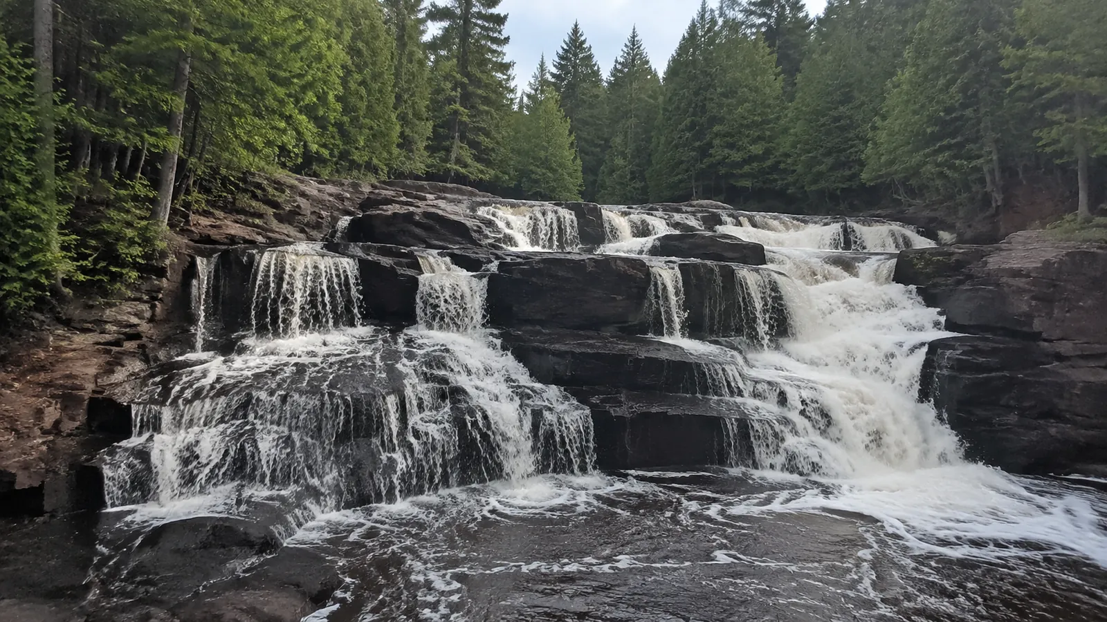
Gooseberry Falls State Park sits about 40 miles northeast of Duluth on Highway 61. The river crosses a series of falls and rapids before reaching Lake Superior, and the visitor-center area provides relatively straightforward access to the best-known Upper, Middle, and Lower falls.
Minnesota DNR’s official North Shore waterfall itinerary describes a 1-mile Falls Loop with hills, gravel, boardwalks, and stairs. It also notes accessible parking, sidewalks, buildings, restrooms, and an accessible route toward the Upper and Middle falls area.
Accessible does not mean every viewpoint or trail surface works for every visitor. Call the park for current conditions and request exact information about grade, barriers, snow, and restroom operation if those details decide the day.
Wet basalt can be astonishingly slippery, even when other visitors are standing on it for photos. Use the viewing routes, supervise children closely, and do not assume shallow-looking water is harmless near a drop.
Can You Combine Gooseberry and Split Rock?
Yes, if you want one waterfall stop and one lighthouse or shoreline stop. Give Gooseberry at least two hours, then treat anything else as the bonus rather than rushing the waterfall loop to hit a checklist.
If waterfalls are the entire purpose, continue to Tettegouche instead of spending the whole day getting in and out of parking lots. The larger Great Lakes road-trip route helps place Duluth and the North Shore in a trip that respects their distances.
Tettegouche: High Falls and Illgen Falls
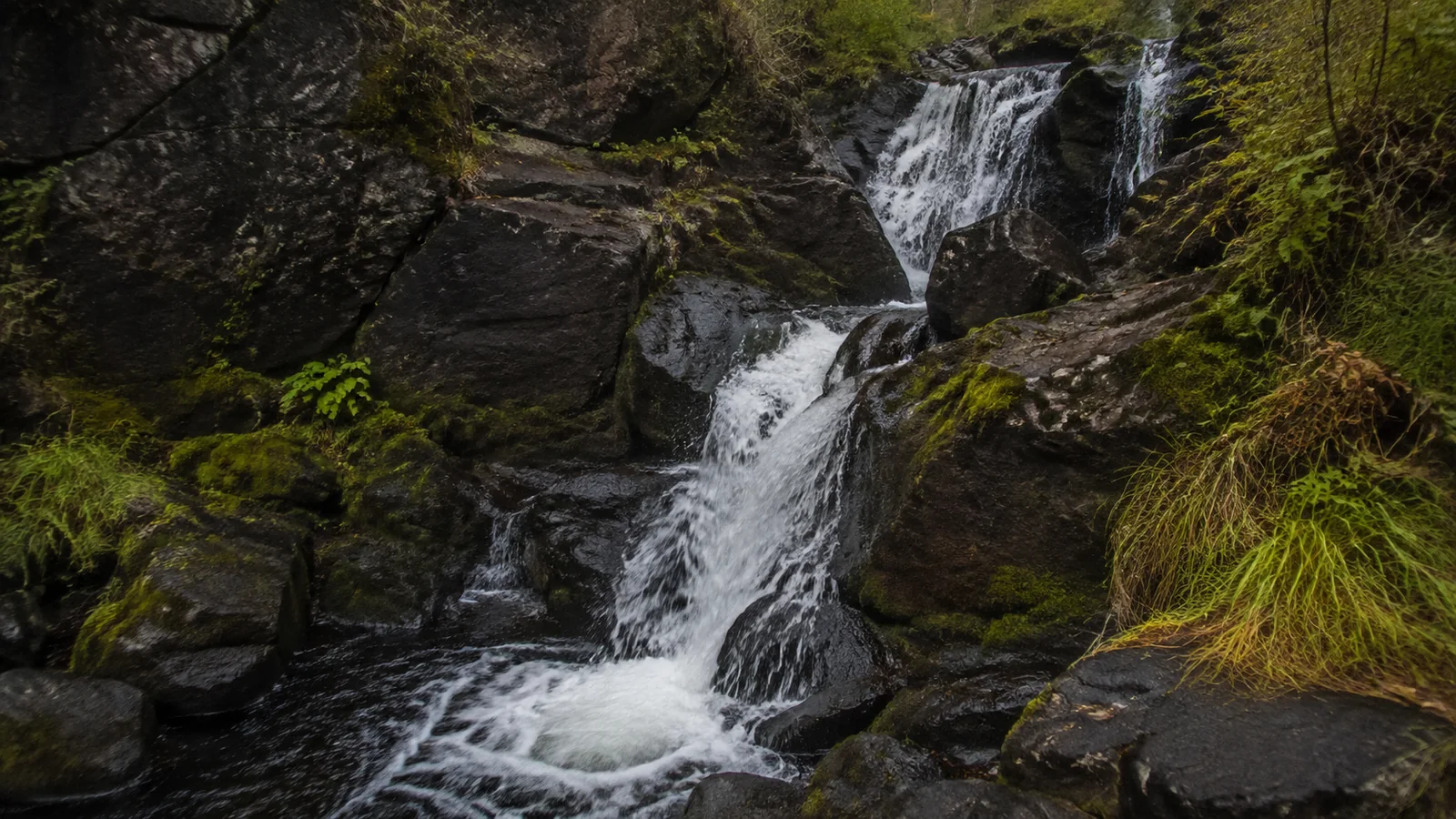
Tettegouche State Park is roughly 60 miles beyond Duluth, depending on your trailhead and route. Its 63-foot High Falls on the Baptism River requires a proper hike, while Illgen Falls is reached from a different park access and should be planned separately.
A new pedestrian bridge upstream of High Falls opened in November 2025 after the previous bridge suffered severe flood damage. That restored an important connection, but it does not remove the need to check current trail and bridge notices before leaving Duluth.
High Falls is the stronger choice for hikers who want a destination rather than a roadside look. Build in several hours, carry water, and do not use an old track that may predate bridge work or current reroutes.
Illgen Falls offers a different angle on the Baptism River and has park lodging nearby, but parking and access are limited. Do not walk along a highway shoulder or block a road because an online photo made the stop look effortless.
Temperance River and Cascade River
Temperance River State Park is farther up Highway 61 and features a narrow gorge, rushing river, and several waterfall views. It is a strong add-on to an overnight North Shore trip, not the third major park I would cram into a Duluth day trip.
Cascade River State Park lies farther still, near Lutsen and Grand Marais. Choose it when you are sleeping on the North Shore, because a same-day Duluth round trip leaves little cushion for weather, darkness, or road delays.
These parks prove that “near Duluth” is elastic in travel articles. My cutoff is whether you can hike without watching the clock and still return before fatigue takes over the drive.
Devil’s Kettle Is Not a Quick Duluth Waterfall
Devil’s Kettle in Judge C. R. Magney State Park is well north of Grand Marais, more than 120 miles from Duluth by road. The river divides around rock, with one side forming the feature that inspired decades of mystery stories.
Treat it as part of a North Shore overnight, not a casual morning from town. The stair-heavy hike, seasonal conditions, and return drive demand more energy than the mileage line on a screen admits.
Wisconsin Waterfalls Near Duluth
Amnicon Falls State Park
Amnicon Falls State Park is southeast of Superior, Wisconsin, and makes an easy cross-border waterfall day from Duluth. Wisconsin DNR describes a series of falls and rapids along the Amnicon River, visible from a covered footbridge and about 2 miles of park trails.
Use the official Amnicon Falls State Park page for current notices, camping, and facilities. A Wisconsin vehicle admission pass is required for vehicles stopping in state parks, so check current purchase options rather than relying on an old fee screenshot.
The falls cluster makes this park satisfying even when your group does not want one long hike. Bridges and overlooks still involve wet surfaces and fast water, so keep the camera inside the railing.
Pattison State Park
Pattison State Park can pair with Amnicon Falls in one Wisconsin day if you start early. Big Manitou Falls drops 165 feet, while Little Manitou Falls drops 31 feet, and the park has more than 7 miles of trails around the Black River landscape.
Check the Pattison State Park information for the current trail, beach, camping, and facility status. Pick one longer trail or several viewpoints instead of assuming the two named falls sit beside the same parking space.
If you add paddling or fishing elsewhere in northern Wisconsin, keep those as separate plans with their own rules and skill needs. The Bois Brule River planning notes make the difference between a waterfall drive and a river trip clear.
A Realistic Two-Day Waterfall Weekend
Day 1: Duluth Creeks
- Start at Chester Park before the busiest part of the day.
- Choose either Tischer Creek or Lester-Amity for the longer walk.
- Eat in town and use the afternoon for the Lakewalk or a scenic overlook.
- Skip natural-surface trails if rain has left them soft.
Day 2: Choose One Direction
- Minnesota: Gooseberry Falls plus one carefully chosen North Shore stop.
- Wisconsin: Amnicon Falls plus Pattison State Park.
- Hiker version: Tettegouche High Falls as the day’s main event.
Do not combine Gooseberry, Tettegouche, Amnicon, and Pattison in one day simply because each looks close to Lake Superior. The lake is enormous, the parks sit in different directions, and border crossing here does not magically shorten the roads.
Best Seasons for Duluth Waterfalls
Spring usually delivers the strongest flow, plus mud, cold spray, lingering ice, and occasional closures. Summer provides long daylight and easier driving, though small city cascades may quiet during dry stretches.
Fall brings color and busy weekends, especially along Highway 61. Winter can be gorgeous, but frozen spray, short daylight, unplowed surfaces, and windchill turn a simple walk into a gear-dependent outing.
Pack traction aids only when you know how and where to use them, and never walk onto river ice near moving water. A frozen-looking waterfall is still a dynamic river system underneath.
Waterfall Safety That Actually Matters
- Stay on managed trails, bridges, stairs, and overlooks.
- Keep back from wet ledges and undercut banks.
- Do not swim or wade above a waterfall.
- Turn around when mud records your footprints.
- Bring layers, water, a light, and offline directions.
- Leave your exact route with someone on longer hikes.
- Keep dogs leashed where required and pack out waste.
Photographs flatten steepness and hide current, which is why a familiar-looking creek can still be dangerous. The best viewpoint is the one you can leave without needing a rescue.

My Honest Ranking by Traveler Type
Choose Gooseberry for first-timers, Tischer Creek for an in-town hour, High Falls for hikers, Amnicon for several cascades with modest mileage, and Pattison for the tallest single drop. Choose Chester or Lester when you want to feel how deeply water shapes Duluth itself.
After the day, these waterfall captions and verified quotes can help with the photos. Just keep the useful details too, because telling a friend about mud, stairs, permits, and closures is more generous than posting another mystery “hidden gem.”