New Zealand Mountains: Best Peaks, Hikes and Views
New Zealand mountains can fill a trip with glacier views, volcanic landscapes, and lakeside peaks, whether you want a short walk or a serious alpine day. I would choose the hikes around your fitness and weather window first, then build the driving route around the views you most want to see.
Why New Zealand’s mountains feel so different
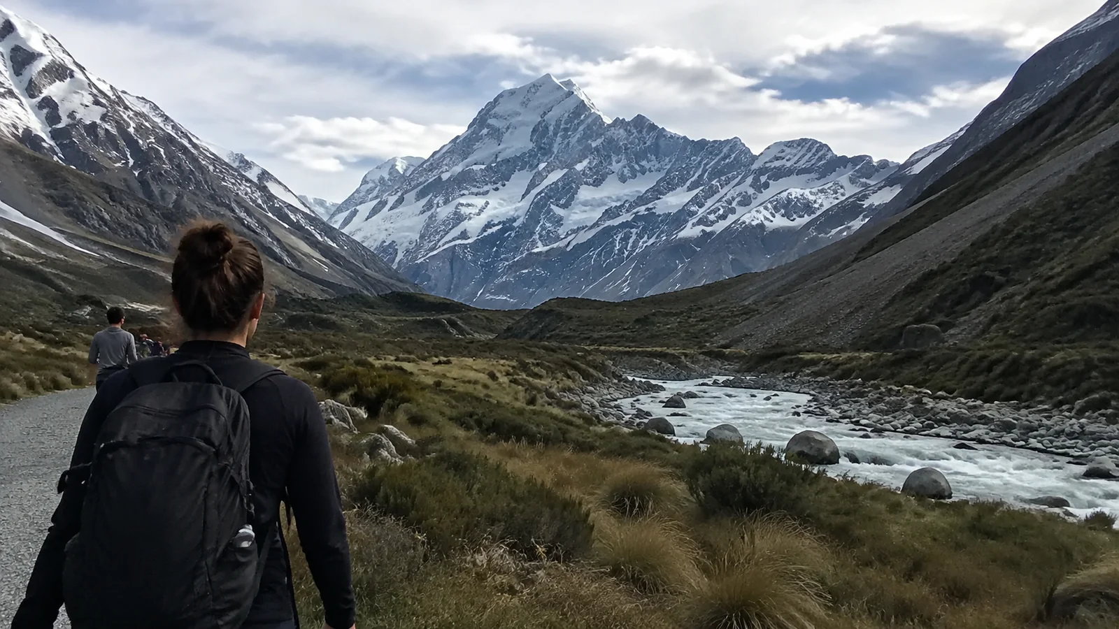
The South Island’s Southern Alps run like a spine through the country, lifting snowy peaks above braided rivers, lakes, rain forest, and the dry Mackenzie Basin. On the North Island, volcanic mountains create a completely different landscape of craters, lava, tussock, and active geothermal systems.
New Zealanders often call a multi-hour hike a “tramp,” and a mountain is a “maunga” in te reo Māori. These are not empty playgrounds: many peaks are ancestors and sacred places for iwi, the Māori tribes connected to them.
Use dual place names when they are provided, follow local requests, and do not treat a summit as something you are automatically entitled to stand on. Respect adds meaning to the view rather than taking anything away from it.
Aoraki/Mount Cook: New Zealand’s highest mountain
Aoraki/Mount Cook rises to about 12,218 feet and anchors the country’s most famous alpine skyline. It is a serious mountaineering objective, not a tourist hike, but the national park offers grand views without ropes or technical climbing.
The Hooker Valley area, Tasman Glacier viewpoints, Kea Point, and village roads can all reveal different faces of the range. Tracks are vulnerable to flood, wind, avalanche, and maintenance closures, so check the Aoraki/Mount Cook National Park page before driving in.
Stay at least one night if the mountain matters to you. Cloud can erase the peaks for hours, while early morning and evening often bring calmer light and far fewer tour buses.
Mueller Hut is a demanding alpine trip above the valley, not a natural next step for everyone who enjoyed Hooker Valley. Assess the current route, snow, booking rules, fitness, and equipment honestly before committing.
Tongariro National Park: volcanoes and crater country
Tongariro brings together Tongariro, Ngāuruhoe, and Ruapehu in one extraordinary volcanic landscape. The popular Tongariro Alpine Crossing passes old lava, exposed ridges, crater terrain, and jewel-colored lakes on a one-way route.
Its fame does not make it easy. Weather can bring strong wind, cold, cloud, snow, ice, intense sun, and poor visibility, while volcanic hazards remain real.
Check the official Tongariro Alpine Crossing information for current alerts, recommended booking steps, parking arrangements, shuttle guidance, and track conditions. Do not build a same-day flight or a nonrefundable evening plan around a crossing that may be unsafe.
In winter conditions, the route requires alpine skills and equipment that summer hikers may not possess. A local guided trip can be the right answer, and turning around can be the smartest achievement of the day.
Shorter park walks provide volcanic views without completing the crossing. Taranaki Falls, Tawhai Falls, and lower routes can still be affected by weather, so “short” never means “check nothing.”
Taranaki Maunga: beautiful, steep, and underestimated
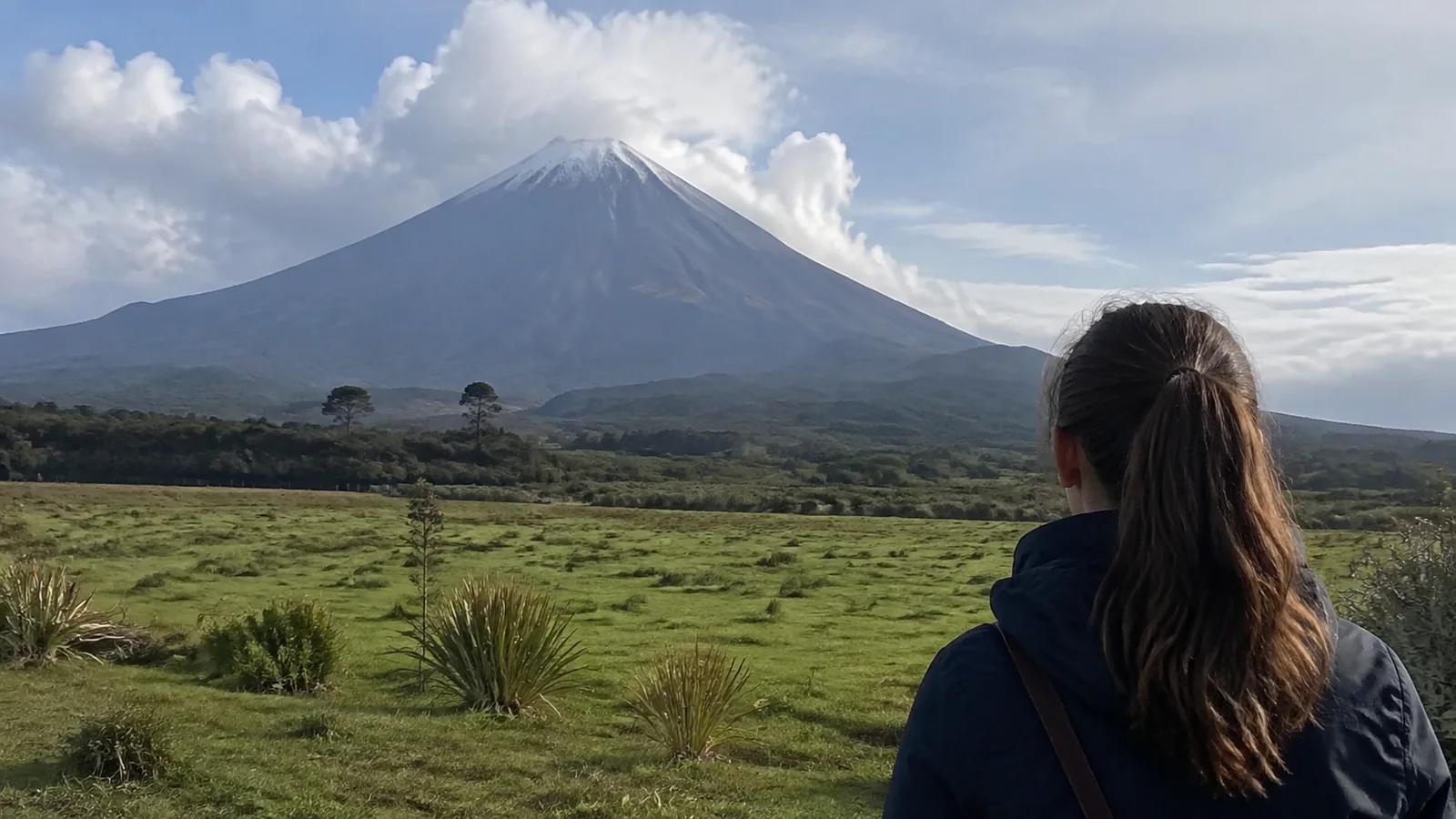
Taranaki Maunga rises alone above its surrounding ring plain, which makes the cone look deceptively simple. The summit route is a steep, exposed alpine undertaking with loose rock, fast weather changes, snow, and ice depending on season.
This maunga is culturally significant and should be approached with care. If you lack navigation, snow travel, and self-rescue skills for the conditions, choose a lower track or a guided experience.
The Pouakai area offers tarn, forest, and mountain views without making the summit the only prize. Overnight facilities and popular tracks can require bookings, while weather may turn a famous reflection photo into gray cloud and ripples.
Queenstown mountains: easy access, real terrain
Queenstown puts mountain scenery directly behind cafes, hotels, and the lakefront. The gondola supplies an effortless high viewpoint, while Ben Lomond asks for a long climb and significantly more weather judgment.
The Remarkables live up to their name from town and become a ski area in winter. Road access, lift operations, snow chains, and summer recreation rules vary, so verify with the operator before driving up.
Nearby Glenorchy opens the door to the Routeburn, Rees-Dart, and other backcountry trips. The scenery becomes wilder quickly, and a paved tourist center is no guarantee that the next valley has cell service or simple road access.
Wānaka and Mount Aspiring country
Wānaka is the gentler lake-town base many travelers wish they had given an extra day. Roys Peak supplies the famous lake-and-ridge view, but its sustained climb, exposed sun, limited trailhead parking, and seasonal access deserve planning.
Mount Aspiring National Park extends far beyond that one photograph. Rob Roy Glacier, Matukituki Valley routes, and multi-day tramps bring swing bridges, river valleys, beech forest, and alpine walls into the picture.
Unsealed approach roads can include fords and may be unsuitable after rain. Confirm conditions and never drive into flowing water simply because another vehicle crossed first.
Fiordland mountains and the Great Walks
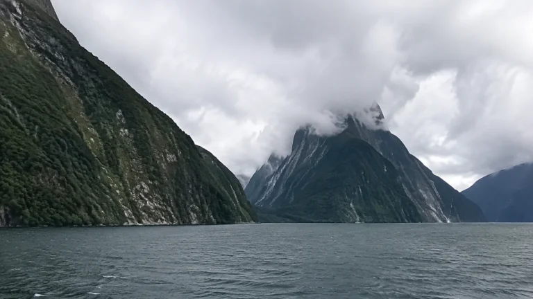
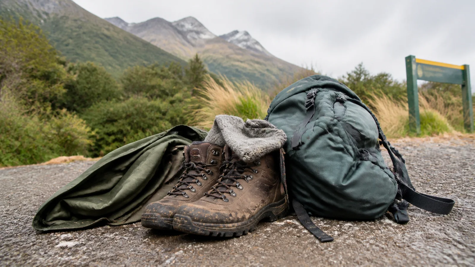
Fiordland’s peaks rise almost straight from deep lakes and fiords, with waterfalls appearing everywhere after rain. Milford Sound provides the easiest grand reveal, but the Milford, Routeburn, and Kepler tracks let prepared walkers enter the landscape.
Great Walk huts and campsites are not casual walk-up lodging during the main season. Review the Department of Conservation Great Walks page for current dates, capacity, prices, transport, and booking requirements.
The Milford Track requires boat and road logistics, while the Routeburn starts and ends hundreds of road miles apart. A track may look compact on a map yet require a carefully coordinated transfer.
Rain is part of Fiordland, not necessarily a ruined vacation. Waterproof layers, dry bags inside the pack, warm insulation, and a safe-weather threshold make the difference between atmospheric and miserable.
Arthur’s Pass and the Canterbury high country
Arthur’s Pass crosses the Southern Alps between Canterbury and the West Coast, placing short walks and hard routes near the highway and railway. The road and TranzAlpine train deliver wonderful scenery even when a summit is not sensible.
Avalanche Peak is steep, exposed, and intended for experienced hikers in suitable conditions. Waterfall walks, valley tracks, and village viewpoints provide much friendlier options when cloud sits low or legs need a quieter day.
Farther south, the Mackenzie Basin frames Aoraki and neighboring peaks above Lakes Tekapo and Pūkaki. Roadside views are excellent, but pull completely off the road only at legal areas and never wander onto private farmland for a photograph.
Nelson Lakes and the Kaikōura ranges
Nelson Lakes National Park combines glacial lakes, beech forest, ridges, and demanding backcountry circuits. Lakeside walks near St Arnaud are approachable, while high passes can hold snow and expose hikers to serious weather.
The Kaikōura ranges create the unusual sight of steep mountains rising close to the Pacific. View them from the coast, choose a lower foothill trail, or book an experienced operator for an activity that matches your actual skills.
These quieter regions suit travelers who want mountain scale without organizing the whole trip around Queenstown. They still require track checks, weather judgment, and realistic driving times.
Best season for New Zealand mountains
December through February generally brings warmer temperatures and longer daylight, but also popular tracks, limited lodging, and strong sun. Alpine rain, wind, and cold remain possible in midsummer.
March and April can deliver crisp days and autumn color in some regions, with shorter daylight and a growing chance of cold. Spring mixes lengthening days with lingering snow, avalanche conditions, wet ground, and unstable weather.
Winter belongs to skiers, snowboarders, experienced alpine travelers, and visitors happy to enjoy snowy mountains from towns and roads. A summer hiking description should never be used as winter route advice.
How difficult are New Zealand mountain hikes?
Here are the route numbers I would compare before booking a shuttle or hut, checked against DOC and local official visitor information on September 5, 2026. Distances use kilometers because that is what you will see on local signs, and walking times exclude lengthy meals, photographs, and transport.
- Tongariro Alpine Crossing: 20.2 kilometers one way, normally 7 to 8 hours in suitable summer conditions, starting at Mangatepōpō and finishing at Ketetahi. The route rises from about 1,120 meters to Red Crater at 1,886 meters, a 766-meter net climb to its high point with additional undulations, followed by a long descent.
- Roys Peak: 16 kilometers round trip, about 5 to 6 hours, and roughly 1,300 meters of climbing from the Wānaka-Mount Aspiring Road trailhead. The official visitor guide to Roys Peak makes clear why this exposed uphill walk needs a full hiking day and good fitness.
- Mueller Hut: 5.2 kilometers each way from the White Horse Hill area, about 4 hours up and 3 hours down, with roughly 1,000 meters of vertical gain to the ridge. DOC’s Mueller Hut route description distinguishes the marked alpine route above Sealy Tarns from a maintained walking track.
- Ben Lomond summit from Queenstown: 14 kilometers round trip and 6 to 8 hours using the Tiki Trail from the Skyline base on Brecon Street. The DOC Queenstown walking guide gives 1,438 meters of elevation gain from town, so a downtown trailhead does not make this a casual stroll.
I would only choose one of these longer routes when the slowest person has the fitness, equipment, and experience for the actual conditions. In particular, snow or ice can change the required skills completely, and the Tongariro winter allowance is about nine hours rather than the summer estimate.
The first-time walks I would choose by region
- Tongariro: Start with Taranaki Falls, a 6-kilometer loop taking about two hours from Whakapapa Village. I would choose the waterfall and varied volcanic country for a first park day, then consider the Crossing on a separate day with the right forecast and shuttle booking.
- Aoraki/Mount Cook: Choose the Tasman Glacier View Track from Tasman Valley car park when your weather window is short. Allow about 40 minutes round trip and a roughly 100-meter climb with more than 300 steps, a much smaller commitment than Mueller Hut but still a real stair workout.
- Wānaka: My first choice for travelers who want a view without the Roys Peak climb is Mount Iron, a 4.5-kilometer loop taking about 90 minutes with roughly 250 meters of gain. It delivers lake and mountain context while leaving energy for the rest of the day.
- Queenstown: Fit walkers wanting a shorter mountain day can use the gondola and walk to Ben Lomond Saddle, about 7 kilometers round trip and 3 to 4 hours from the upper complex. I would stop at the saddle instead of adding the steeper summit, while anyone wanting an easy outing should enjoy the gondola viewpoint and a lakefront walk.
- Taranaki: Choose the Kapuni Loop to Dawson Falls, 1.4 kilometers and about an hour from the Dawson Falls visitor area. Forest and the waterfall make a rewarding lower-level introduction, but the unbridged stream can be impassable after heavy rain, so use the visitor-area views if the crossing is unsafe.
- Arthur’s Pass: I would choose Devils Punchbowl, a 2-kilometer round trip taking about an hour from the village’s northern end. Expect stairs and an uphill approach to the waterfall, with a much smaller commitment than exposed Avalanche Peak.
- Fiordland: The Milford Foreshore Walk is a 400-meter loop for which I would allow about 30 minutes of wandering and photographs. It is my choice for mountain scale without a long hike, with Mitre Peak rising above the water when cloud allows.
- Nelson Lakes: Start at Kerr Bay in St Arnaud with DOC’s 15-minute Bellbird Walk, or extend onto the 45-minute Honeydew Walk. I would choose this sheltered forest and lake pairing on a short day instead of committing to a high ridge, and listen for the birds the restoration project supports.
Roys Peak closes for lambing from October 1 through November 10, so use Mount Iron during that period and verify access again before setting out. At Tongariro, stay on marked tracks and respect the restorative rāhui over areas affected by the 2025 fires, alongside the longstanding requests to respect sacred peaks and lakes.
Track labels refer to terrain and expected skill, not whether a social-media creator looked cheerful at the top. Distance alone also misses elevation gain, river crossings, mud, roots, scree, exposure, and the lack of a quick exit.
Build your trip from valley walks toward harder routes rather than scheduling the biggest hike for the morning after an overnight flight. Jet lag, dehydration, unfamiliar sun, and a rental car pickup are poor training partners.
The New Zealand Mountain Safety Council’s Plan My Walk tool combines route information, alerts, weather, gear guidance, and a shareable trip plan. Use it alongside current DOC notices and local advice.
Weather can cancel the plan
New Zealand’s maritime setting produces rapid changes, and mountain forecasts can differ sharply from a nearby town forecast. Check the specific elevation and route, not only the sunny icon for Queenstown or Taupō.
Set a turnaround time before leaving and name the conditions that will make you use it. Thick cloud, rising water, unstable footing, thunder, strong wind, unexpected snow, or a slower group member all deserve a decision.
Carry a paper map and compass where the route requires them, then know how to use both. A downloaded map and charged phone help, but batteries fail and reception disappears.
Snow and avalanche safety
Backcountry avalanche terrain is not controlled like an open ski slope. Check the New Zealand Avalanche Advisory, understand the forecast, and avoid avalanche terrain unless the group has the necessary education and rescue equipment.
Microspikes are not a substitute for crampons, an ice axe, and the skills to use them on steep frozen terrain. If that distinction is unfamiliar, book a qualified guide or choose a lower route.
What to pack for a mountain day
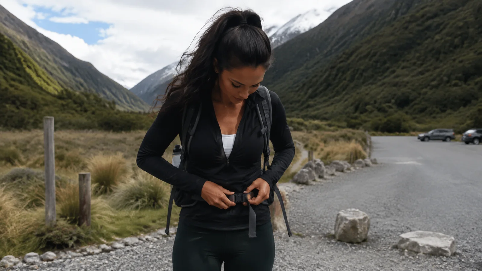
- Supportive footwear suited to the track
- Waterproof jacket and rain pants
- Warm layers, hat, and gloves
- Sun hat, sunglasses, and sunscreen
- More food and water than the ideal schedule requires
- Offline map plus route-appropriate navigation tools
- First-aid and blister supplies
- Headlamp with spare power
- Emergency shelter
- Communication device appropriate to the remoteness
Do not drink untreated stream water simply because it looks clean. Pack out every scrap, clean mud and seeds from gear, stay on durable surfaces, and give wildlife room.
Build a mountain-focused New Zealand trip
For a first South Island route, combine Christchurch, the Mackenzie Basin, Aoraki/Mount Cook, Wānaka, Queenstown, and Fiordland over at least ten to fourteen days. That still requires choices, because weather and road time will happily consume the spare hours.
A North Island mountain route can connect Auckland, Tongariro, and Taranaki with geothermal and coastal stops. Never schedule both major alpine objectives back to back without room for a weather alternative.
These hiking preparation ideas help match a route to your goals, while this backpacking and hiking comparison explains the gear jump for overnight trips. For another country where forecasts set the itinerary, these Iceland planning tips are a useful companion.
New Zealand mountains FAQs
Can beginners enjoy New Zealand’s mountains?
Absolutely, because many national parks offer short valley walks, road viewpoints, gondolas, and guided experiences. Beginners should select beginner terrain rather than assuming every famous track is designed for them.
Can you climb Aoraki/Mount Cook?
Aoraki is a technical mountaineering objective with serious hazards, not a marked hiking trail. Most travelers should enjoy it from national park tracks and viewpoints.
Do mountain huts need reservations?
Some do and some operate first come, first served, with rules changing by hut and season. Check the exact DOC facility before departure and never assume an empty bunk will be available.
Final thoughts
The best New Zealand mountain trip is not the one with the most summits. It is the one that pairs bold scenery with good decisions, flexible days, and routes everyone can finish with energy left for dinner.
Give the weather a vote, treat every maunga with respect, and keep a lower walk ready for the cloudy days. The mountains will still feel enormous, even when you admire them from the valley.