Bermuda Triangle Cruises: Routes, Myths and What Really Happens
Cruise ships regularly sail through waters associated with the Bermuda Triangle, and nothing unusual happens. The Triangle has no official boundary, NOAA finds no evidence of more mysterious disappearances there, and the risks worth planning for are ordinary maritime ones: storms, waves, reefs, mechanical problems, and human error.
Can you take a Bermuda Triangle cruise?
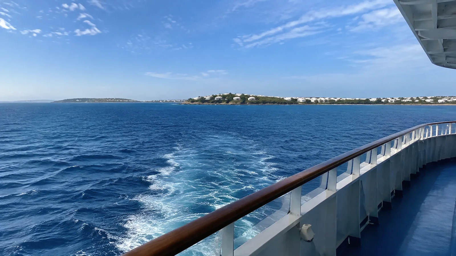
Yes, although most cruise lines do not market a standard itinerary under that name. Cruises from Florida to Bermuda, the Bahamas, and parts of the eastern Caribbean cross waters commonly included in popular drawings of the Triangle.
Routes vary by homeport and port order, and the “triangle” itself varies from map to map. A Miami-to-Bahamas cruise may sit inside one version while a New York-to-Bermuda route only crosses an edge in another.
The lack of one accepted boundary is central to the story. NOAA says no official map delineates the Bermuda Triangle and the U.S. Board on Geographic Names does not recognize it as an official name.
Where is the Bermuda Triangle?
The familiar popular outline connects Miami, Bermuda, and Puerto Rico. Those points create a huge section of the western North Atlantic containing busy shipping lanes, major cruise routes, commercial aviation, island chains, deep water, shallow banks, and rapidly changing weather.
Some writers expand or shrink the boundaries to include a particular incident. That flexibility makes dramatic case lists easy to build and statistical comparisons difficult to defend.
A real navigational hazard needs charted coordinates, observed conditions, and an identifiable mechanism. A shape that changes to fit the story is folklore, not a formal marine forecast zone.
Do cruise ships disappear in the Bermuda Triangle?
There is no evidence that cruise ships mysteriously vanish more often in these waters. NOAA states that mysterious disappearances do not occur with greater frequency there than in other large, heavily traveled ocean areas.
The U.S. Coast Guard’s historical FAQ is equally direct: it does not recognize the Triangle as an area of specific hazard, and reviews of losses have found physical causes rather than extraordinary factors.
That does not mean no ship or aircraft has ever been lost in the region. It means ordinary explanations such as severe weather, navigational error, structural failure, fire, fuel limitations, and incomplete historical records are sufficient without invoking a supernatural force.

What happens when a cruise ship crosses it?
For passengers, usually nothing identifiable. There is no border to announce, no special maritime ceremony, and no official line displayed on navigational charts.
The bridge team continues normal watchkeeping, route monitoring, weather review, traffic avoidance, and communication. If conditions change, the captain can alter speed or course just as on any other ocean passage.
You may notice rough water, a schedule change, rain, or a windy deck, but none proves the ship crossed a paranormal zone. The same experiences occur in the North Atlantic, Mediterranean, Pacific, and every other cruise region.
The real maritime conditions behind the legend
Fast-changing tropical weather
The western Atlantic can produce thunderstorms, squalls, waterspouts, tropical storms, and hurricanes. These are measurable weather hazards with forecasts and warnings, not unexplained phenomena.
Atlantic hurricane season officially runs June 1 through November 30, with activity clustering around a September climatological peak. Ships can change route, but ports, airports, and coastal roads may still be disrupted.
Our guide to September cruises explains why a flexible Caribbean traveler should book for the ship as well as the ports. The Triangle legend does not change the practical insurance and arrival-day advice.
The Gulf Stream
The Gulf Stream is a powerful current flowing through the region. It can move floating debris, affect sea state, create strong temperature boundaries, and complicate a small craft’s situation when wind opposes current.
For a modern cruise ship, the current is a route-planning and operating factor, not a mysterious conveyor belt. Mariners account for currents when estimating track, speed, fuel, arrival time, and weather exposure.
Deep water and shallow banks
The region contains both very deep ocean and broad shallow areas around the Bahamas. Reefs, shoals, channels, and islands demand accurate charts and navigation, particularly for small vessels operating close to shore.
Deep water can make recovery and investigation difficult after a loss. When wreckage is not found, a gap in evidence can turn into a legend even though absence of wreckage does not prove an extraordinary cause.
Heavy traffic
Florida, the Bahamas, Puerto Rico, and the U.S. East Coast generate enormous commercial, recreational, and cruise traffic. A large number of voyages naturally creates a large number of incidents without showing an unusual incident rate.
Good analysis compares losses with exposure, vessel type, weather, era, and reporting quality. Simply counting famous stories across centuries tells you very little.
Human decisions
Navigation, maintenance, loading, fatigue, communication, and weather judgment all affect safety. Human fallibility is less exciting than a magnetic anomaly, but it is a documented factor in maritime casualties worldwide.
Modern procedures add layers of checking and training. They reduce risk without making any voyage immune to mistakes or equipment failure.
Do compasses stop working in the Bermuda Triangle?
No special compass failure has been established for the area. Magnetic compasses everywhere need adjustment for variation between magnetic and true north, and ships also manage instrument error through normal navigation practice.
Magnetic variation changes by location and over time, which is why charts and electronic systems use current data. That is a global navigational reality, not evidence of a Triangle effect.
Modern ships also use multiple independent sources, including satellite positioning, radar, electronic charts, visual observations, depth information, and radio communication. Redundancy matters because any single sensor can fail.
Can the weather make a Bermuda cruise rough?
Absolutely, especially on open-ocean routes from the Northeast. A Bermuda cruise can meet wind and swell without any tropical system, while a calm crossing can occur during hurricane season.
NOAA describes rogue waves as real, large, unexpected waves and notes a documented 60-foot example in the Gulf Stream off Charleston. Their existence is a scientific ocean hazard, not proof of a paranormal region.
Passengers sensitive to motion should choose a lower, central cabin and discuss medication with a clinician before departure. A larger ship may feel steadier, but hull design, wave direction, speed, and cabin position also matter.
Which cruises pass through the popular Triangle area?
Florida to Bermuda
A Florida-to-Bermuda itinerary most clearly traverses the center of the popular Miami-Bermuda-Puerto Rico outline. These sailings are less common than departures from New York, Boston, or other northeastern ports, so check current inventory rather than assuming a fixed route exists.
Florida to the Bahamas
Short cruises from Miami, Port Canaveral, Fort Lauderdale, and other Florida ports enter waters commonly drawn inside the Triangle. Thousands of routine itineraries do this as part of ordinary cruise operations.
Florida to the eastern Caribbean
Routes toward Puerto Rico, St. Thomas, St. Maarten, and neighboring islands may pass through or beside popular Triangle boundaries. Their real seasonal concern is tropical weather, not disappearance.
Northeast ports to Bermuda
Boston, New York, Baltimore, and other northeastern departures approach Bermuda across the Atlantic. Depending on the boundary someone draws, portions can be labeled inside the Triangle even though the ship never travels near Miami.
Our current guide to Bermuda cruises from Boston covers the actual decisions that matter: sea days, Dockyard time, terminal transport, weather, and schedules.
Is a Bermuda Triangle cruise safe?
Crossing the popularly defined area does not create a special recognized safety category. Modern cruise ships operate under international and national requirements for construction, navigation, communications, life-saving equipment, fire protection, crew training, and safety management.
No voyage is risk-free, and regulation should not be turned into an “unsinkable” claim. The useful question is whether the ship, operator, itinerary, weather decisions, and your personal preparation meet current standards.
Passenger drills and emergency instructions deserve attention even on a lighthearted vacation. Know your muster information, keep medications accessible, and follow crew directions during an incident.
How captains manage storms
Cruise companies monitor forecasts before and during a voyage, while bridge teams receive updated route and weather information. A captain may change speed, reverse port order, substitute a call, add a sea day, or return to a different location.
Large ships have room to maneuver around many systems, but not every consequence can be avoided. A closed harbor or disrupted homeport may require a major itinerary decision long before passengers see dramatic weather.
The National Hurricane Center publishes forecasts and tropical cyclone climatology, but a seasonal outlook does not predict the weather on your sailing. Check current information close to departure and keep travel plans flexible.

Will the cruise line mention the Triangle?
Some ships may use the topic for trivia, lectures, or playful entertainment, but it is not a navigational milestone. Programming changes by line and sailing, so do not book expecting a themed event unless it is explicitly advertised.
A bridge map may show the ship’s track without labeling the Triangle. That is appropriate because there is no official polygon to cross.
What to book if the legend sounds fun
Choose a Bermuda itinerary if you want a strong destination and genuine Atlantic sea days. Select an eastern Caribbean route if you want several islands, or a short Bahamas cruise if the ship is the main event.
I would not pay a premium for a vague “Triangle” label. Spend the money on a cabin location that suits motion sensitivity, an extra pre-cruise hotel night, or an excursion you actually value.
Travelers interested in maritime history may prefer a transatlantic crossing. Our ocean liners primer explains why a purpose-built liner and a resort cruise ship handle the idea of an ocean voyage differently.
Practical planning checklist
- Book the real ports and ship, not the Triangle mythology.
- Arrive at the embarkation city at least one day early.
- Review hurricane-season exposure for the route and date.
- Choose a lower midship cabin if motion is a concern.
- Carry medication and documents in hand luggage.
- Buy travel protection based on the policy wording.
- Expect ports and times to change for safety or operations.
The honest verdict
Bermuda Triangle cruises are real only in the sense that ordinary cruise routes cross an unofficial area made famous by folklore. NOAA and the Coast Guard find no extraordinary pattern of unexplained loss and recognize no special geographic hazard zone.
The Atlantic still deserves respect. Storms, strong currents, rough seas, reefs, traffic, mechanical failure, and human judgment are genuine, and modern navigation addresses them without needing a supernatural explanation.
Take the cruise for Bermuda, the Bahamas, Puerto Rico, or the pleasure of open water. The best Triangle story is the quiet one: you enjoy dinner, sleep in your cabin, and arrive at the next port exactly as planned.